Text Products
Atlantic Tropical Weather Discussion
000
AXNT20 KNHC 201635
TWDAT

Tropical Weather Discussion
NWS National Hurricane Center Miami FL
1815 UTC Sun Sep 20 2026

Tropical Weather Discussion for North America, Central America
Gulf of America, Caribbean Sea, northern sections of South
America, and Atlantic Ocean to the African coast from the
Equator to 31N. The following information is based on satellite
imagery, weather observations, radar and meteorological analysis.

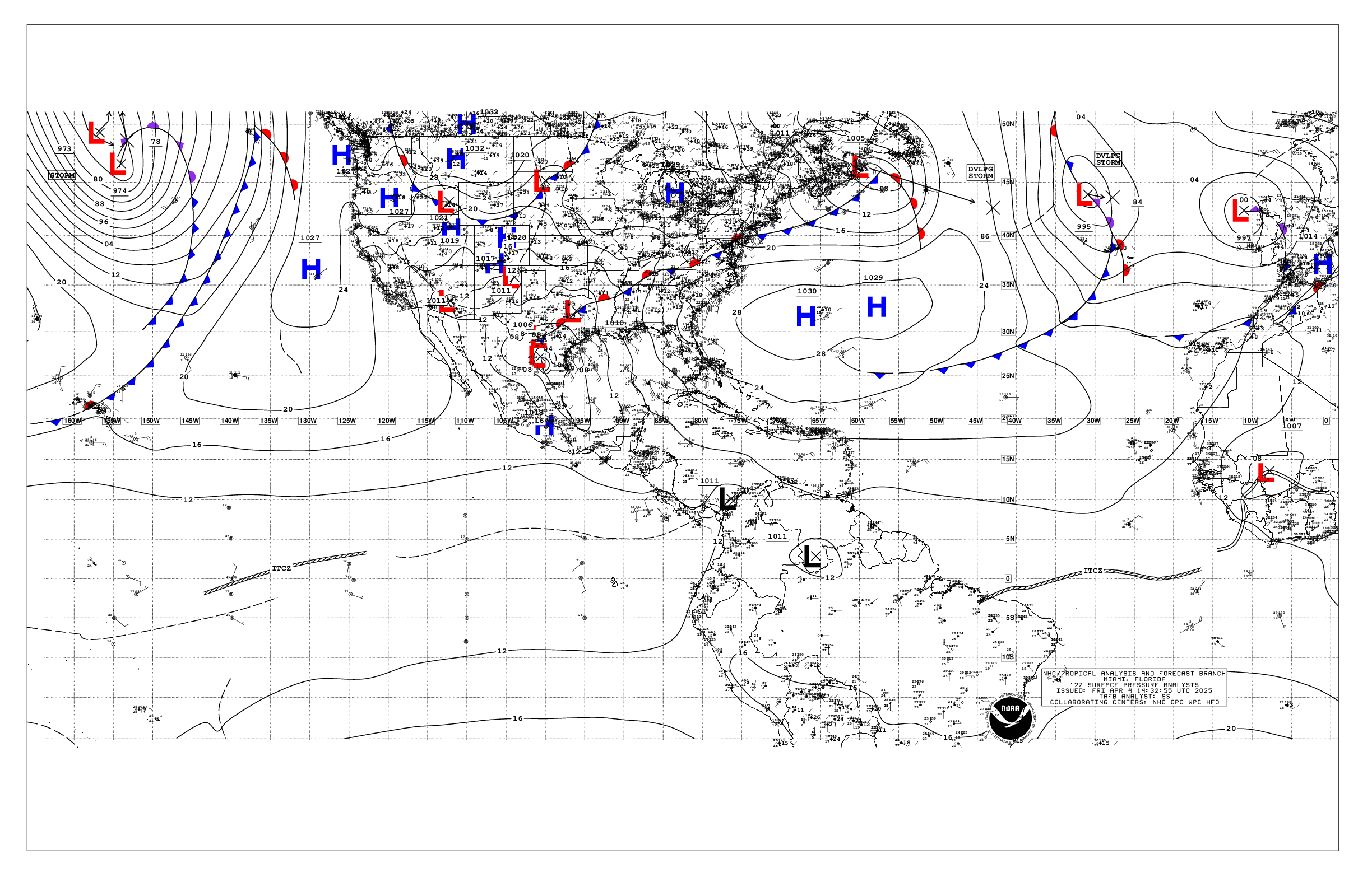
Based on 1200 UTC surface analysis and satellite imagery through
1621 UTC.

...TROPICAL WAVES...

A central Atlantic tropical wave has its axis near 45W, south of
20N, drifting slowly westward. A weak 1015 mb low is also
along this wave axis. However, no significant convection is
depicted at this time in association with this wave.

The western Caribbean tropical wave is transitioning into the
Eastern Pacific, and it is discussed in the Eastern Pacific
Tropical Weather Discussion (TWDEP).

...MONSOON TROUGH/ITCZ...

The monsoon trough extends off the coast of Africa near 18N16W to
08N39W. Aside from convection noted in the Atlantic section
below, scattered moderate convection is noted from 09N to 15N and
east of 21.5W.

...GULF OF AMERICA...

A weak pressure gradient prevails across the area with a weak
trough over the W-central Gulf. An E to W surface trough extends
from the Straits of Florida to near 24N87W. A few showers and
thunderstorms are active along the trough. Scattered showers and
thunderstorms are also active over the northeast Gulf, related to
divergence aloft near an upper low centered over Florida. Light to
gentle winds and 2-4 ft seas prevail across the Gulf.

For the forecast, weak ridging north of the Gulf will maintain
generally gentle to moderate winds across the basin through mid
week. A vigorous upper-level low and associated surface low or
trough over the central Gulf will contribute to scattered showers
and thunderstorms over the eastern Gulf through the midweek, with
the Straits of Florida the most active area.

...CARIBBEAN SEA...

A relatively weak pressure pattern is across the basin with
surface troughs N of the basin interrupting the typical Azores-
Bermuda highs. Moderate to fresh trades and 4-7 ft seas are found
across the south-central Caribbean, with gentle to moderate winds
and 2-4 ft seas elsewhere. An upper level low north of the area is
supporting scattered moderate convection over the NW part of the
basin. Numerous moderate convection is depicted south of 14.5N and
west of 80W in association with the eastern end of the Eastern
Pacific monsoon trough.

For the forecast, a modest pressure gradient between weak high
pressure near Bermuda and the Colombian Low will maintain moderate
to fresh to trades over the south-central Caribbean for the next
several days. A vigorous upper-level low over the Gulf of America
will promote scattered to numerous showers and thunderstorms over
the west and northwestern Caribbean through midweek.

...ATLANTIC OCEAN...

For awareness purposes, Tropical Storm Fay is centered near 34.1N
33.0W at 20/1500 UTC or 370 nm SW of the Azores, moving NE at 3
kt. Estimated minimum central pressure is 1004 mb. Maximum
sustained wind speed is 50 kt with gusts to 60 kt.

Divergence aloft associated with an upper low over Florida is
supporting scattered showers and thunderstorms west of 70W. Farther
east, another upper trough reaches from an upper low near 31N41W
to 26N46W. This upper trough is supporting scattered showers and
thunderstorms from 20N to 31N between 50W and 60W, focused along
a surface trough reaching from 30N60W to 23N50W. In addition, the
upper pattern is supporting scattered showers and thunderstorms
from 20N to 28N between 35W to 43W along a trough from 32N40W to
26N42W. Farther south, scattered to numerous showers and
thunderstorms are active within 75 to 150 nm in the northeast
quadrant of a 1014 mb surface low centered near 15N52W. Broad
ridging covers the eastern Atlantic. Gentle to moderate winds and
3-6 ft seas prevail across the Atlantic discussion area.

For the forecast west of 55W, a very weak pressure gradient
across the western Atlantic will promote variable gentle to
moderate winds across forecast waters for the next several days. A
vigorous upper-level low over the Gulf of America and Florida,
and abundant tropical moisture across the Atlantic will force
scattered showers and thunderstorms across the waters west of 70W
through midweek.

Meanwhile, Tropical Storm Fay is forecast to eventually approach
and move into the discussion waters to near 30N 36W Tue night,
but by then as a remnant low.

$$
KRV