Text Products
Atlantic Tropical Weather Discussion
000
AXNT20 KNHC 240404
TWDAT

Tropical Weather Discussion
NWS National Hurricane Center Miami FL
0615 UTC Sat Oct 24 2026

Tropical Weather Discussion for North America, Central America
Gulf of America, Caribbean Sea, northern sections of South
America, and Atlantic Ocean to the African coast from the
Equator to 31N. The following information is based on satellite
imagery, weather observations, radar and meteorological analysis.

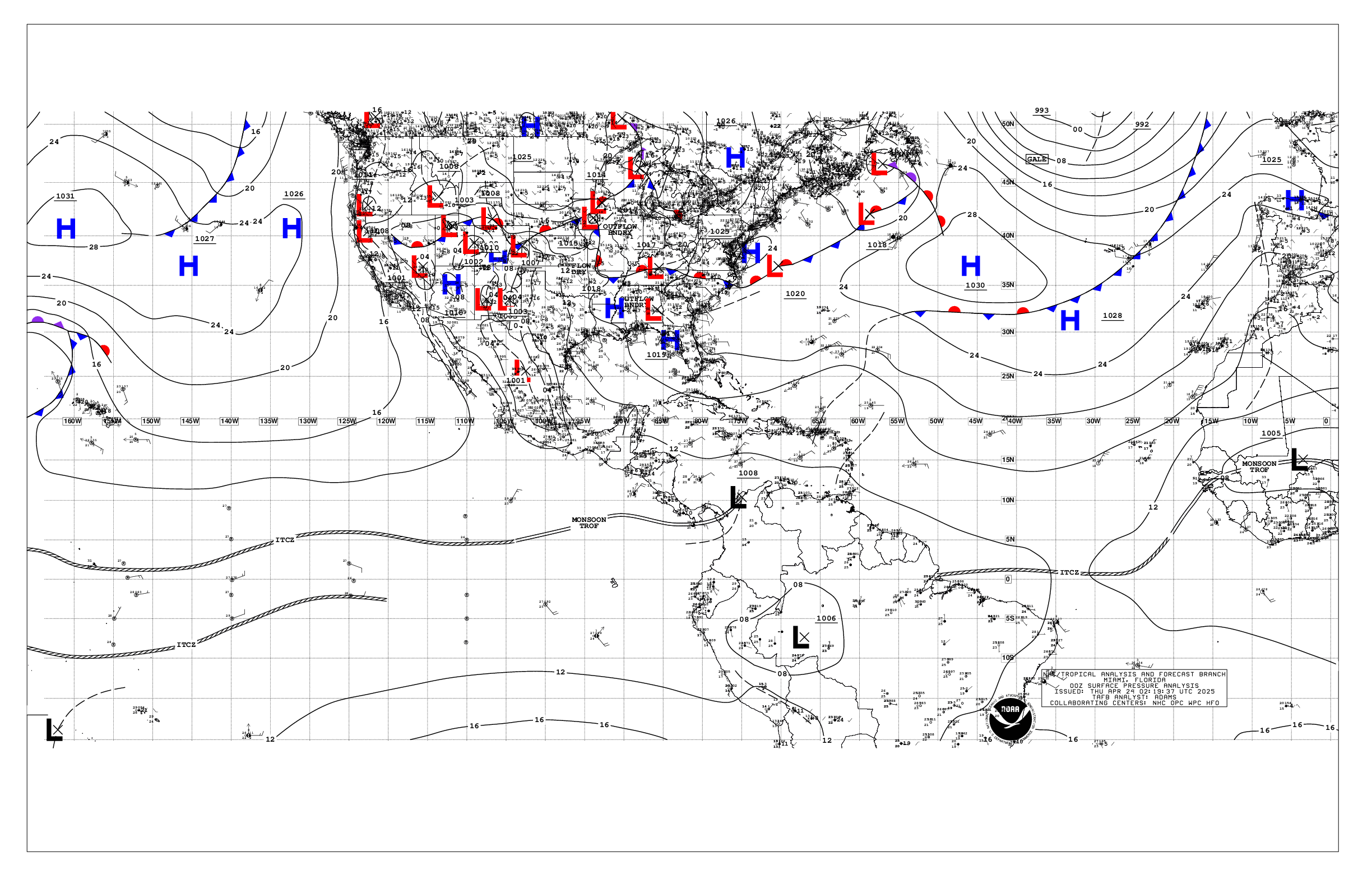
Based on 0000 UTC surface analysis and satellite imagery through
0330 UTC.

...SPECIAL FEATURES...

Atlantic Gale Warning: A tightening pressure gradient will develop
as high pressure builds southward over the western Atlantic and
low pressure deepens near the central Bahamas along a trough or
developing frontal boundary. This synoptic setup is expected to
induce widespread fresh to strong NE to E winds and rough to very
rough seas, with winds likely reaching gale-force over much of the
waters north of 27N and W of 60W Sat night through Sun night.
Mariners are urged to remain alert to these dangerous marine
conditions, and take the necessary precautions to avoid the
affected areas.

Please, see the latest NWS High Seas Forecast issued by the
National Hurricane Center at website
https:www.nhc.noaa.gov/text/MIAHSFAT2.shtml for further details.

Heavy Rainfall Event in the North Caribbean: A mid to upper level
trough over the northern Caribbean combined with abundant tropical
moisture will support periods of heavy rain over eastern Cuba,
Hispaniola, Jamaica, the southern Bahamas, and the Turks and
Caicos Islands through Mon. By mid-week, the trough is forecast
to weaken while moving eastward into the central Atlantic. Heavy
rainfall will raise concerns for dangerous and life-threatening
flash flooding.

Please refer to your local weather services and the International
Desk at the Weather Prediction Center for more information.

...MONSOON TROUGH/ITCZ...

The monsoon trough extends from the coast of Africa near 12N16W
to 11N25W. The ITCZ extends from 11N25W to 12N32W, and resumes
from 11N39W to 11N62W. A surface trough is analyzed along 35W from
10N-20N. Scattered moderate and isolated strong convection is
from 05N to 18N and E of 45W.

...GULF OF AMERICA...

High pressure over the eastern United States extends a ridge over
the western Gulf waters. The pressure gradient between this ridge
and a trough over the Caribbean is supporting moderate winds, and
moderate seas, E of 94W. Gentle winds, and slight to moderate
seas, prevail W of 94W.

For the forecast, the broad ridge will continue supporting moderate
to fresh NE to E winds across most of the Gulf region, except
locally strong E of 84W. A tightening pressure gradient between
the high pressure and low pressure forecast to deepen near the
central Bahamas will bring fresh to strong NE winds and rough seas
over the eastern Gulf, including the Florida Straits, beginning
later tonight through early next week.

...CARIBBEAN SEA...

Please see the Special Features section above for information
about the potential for heavy rainfall over eastern Cuba,
Hispaniola, and Jamaica.

An upper level trough over the eastern Gulf of America and NW
Caribbean supports scattered to numerous showers and thunderstorms
over the north-central Caribbean and Windward Passage. A broad
trough extends across the central and SW Caribbean, with light
winds and slight to moderate seas west of 76W. Moderate to fresh
winds and moderate seas prevail E of 76W.

For the forecast, the scattered to numerous showers and
thunderstorms over the north-central Caribbean and Windward
Passage will prevail through Sun night. Light winds and slight to
moderate seas will prevail across the central and SW Caribbean
west of 76W through Sat, and moderate to fresh E to SE winds and
moderate seas are expected east of 76W. Fresh N to NE winds will
develop across the western Caribbean, with building seas west of
80W early next week as high pressure builds north of the area.
Expect rough seas and large N swell across the Yucatan Channel Mon
and Tue. Little change is expected elsewhere.

...ATLANTIC OCEAN...

Please see the Special Features section above for information
about a Gale Warning over the western Atlantic, and a heavy rain
event over the southern Bahamas and the Turks and Caicos Islands.

A surface trough extends from 29N68W to low pres near 24N72W to
20N74W. Numerous moderate and scattered strong convection is
within 150 nm southeast of the trough and west of 61W. Moderate
winds, and moderate to rough seas are west of the trough. Another
trough extends from 31N53W to 28N58W. Scattered showers are noted
within 90 nm east of the trough. Fresh to strong winds, and rough
seas, are within 90 nm east of the trough and N of 29W. Fresh to
strong winds are between the Cabo Verde Islands and western
Africa, where rough seas are noted. Moderate to fresh winds, and
moderate seas, are elsewhere east of 50W. Gentle to moderate
winds, and moderate seas, prevail elsewhere.

For the forecast west of 55W, large northerly swell across the
forecast waters W of 65W and NE of the Bahamas will gradually
subside tonight through early Sat. A tightening pressure gradient
will develop across the northwestern zones tonight as high
pressure builds southward over the western Atlantic, and low
pressure deepens near the central Bahamas south of a cold front
moving slowly southward into the area. This setup is expected to
induce widespread fresh to strong NE to E winds and rough to very
rough seas, with winds reaching gale-force over much of the waters
north of 28N and between 60W and 75W early Sun through Sun night.
Mariners are urged to remain alert to these dangerous marine
conditions, and take the necessary precautions to avoid the
affected areas.

$$
ERA