Text Products
Atlantic Tropical Weather Discussion
582
AXNT20 KNHC 210846
TWDAT

Tropical Weather Discussion
NWS National Hurricane Center Miami FL
1215 UTC Mon Sep 21 2026

Tropical Weather Discussion for North America, Central America
Gulf of America, Caribbean Sea, northern sections of South
America, and Atlantic Ocean to the African coast from the
Equator to 31N. The following information is based on satellite
imagery, weather observations, radar and meteorological analysis.

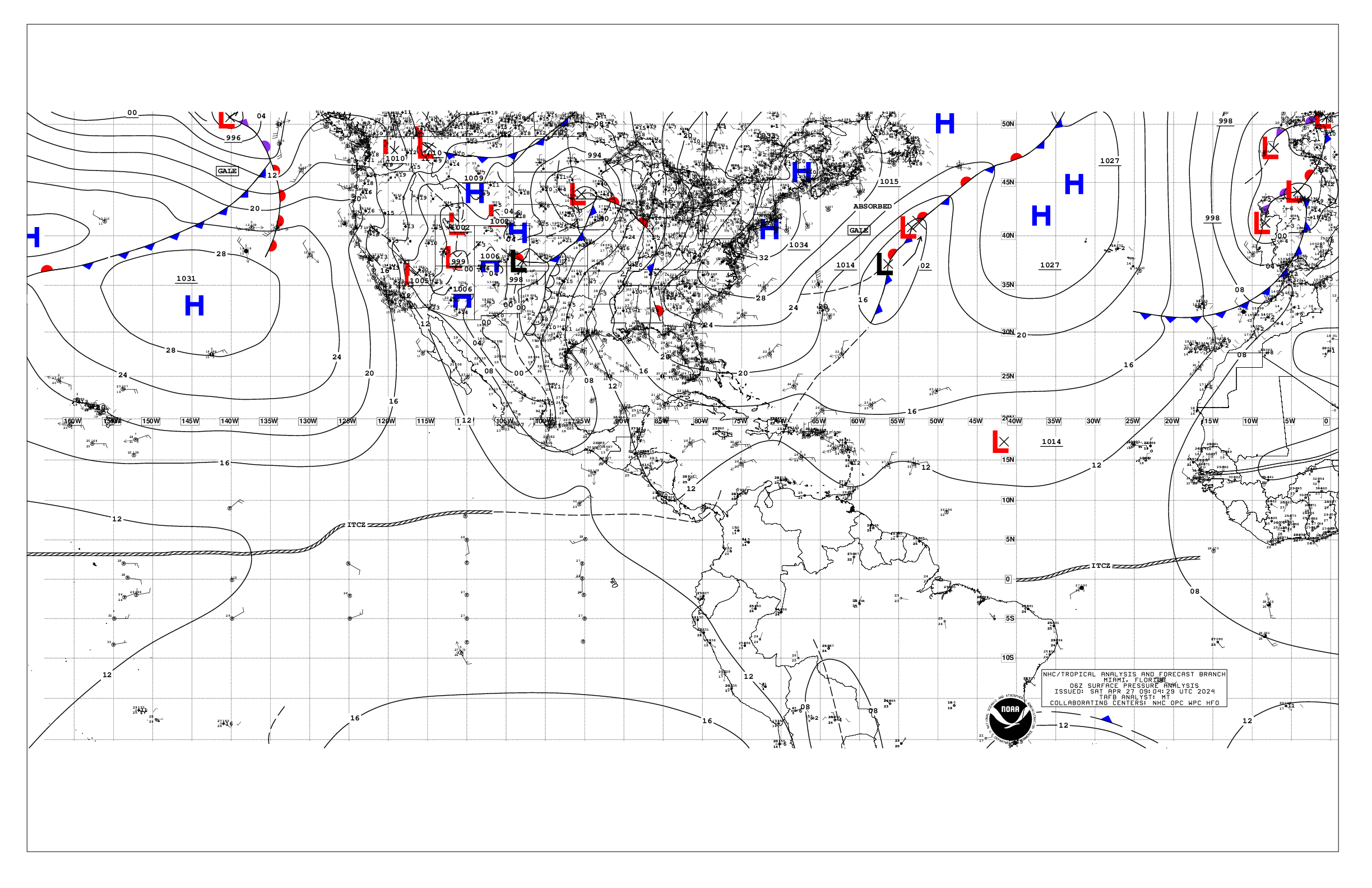
Based on 0600 UTC surface analysis and satellite imagery through
0830 UTC.

...TROPICAL WAVES...

An eastern Atlantic tropical wave has its axis near 30W, south of
18N, moving eastward at around 10 to 15 kt. No significant
convection is noted with this wave.

A central Atlantic tropical wave has its axis near 46W, south of
21N, drifting slowly westward. Scattered moderate convection is
active on the northern end of the tropical wave from 18N to 21N
between 43W and 45W.

...MONSOON TROUGH/ITCZ...

The monsoon trough extends off the coast of Africa near 15N17W to
09N25W. The ITCZ extends from 07N30W to 04N50W. Scattered
moderate convection is noted from 10N to 15N and east of 20W.

...GULF OF AMERICA...

A weak pressure gradient prevails across the area generating
light to gentle winds and slight seas across the Gulf. An upper
low centered over west-central Florida is supporting clusters of
showers and thunderstorms south of Apalachicola, Florida, and
over the Florida Straits.

For the forecast, weak surface ridging across the southeastern U.S.
will maintain generally gentle to moderate winds across the
basin through midweek. A vigorous upper-level low and associated
surface trough over the southern Gulf will contribute to
scattered showers and thunderstorms over the eastern Gulf through
midweek, with the Straits of Florida the most active area. A cold
front may sink into the northern Gulf Thu night through Fri,
leading to a modest increase in winds across the basin.

...CARIBBEAN SEA...

A relatively weak pressure pattern is across the basin. Moderate
to fresh winds and moderate seas prevail east of 80W. Light to
gentle winds and slight to moderate seas prevail west of 80W.
An upper trough reaches from the eastern Gulf into the northwest
Caribbean. Divergent flow aloft on the southeast side of the upper
trough is supporting clusters of showers and thunderstorms between
Nicaragua and Jamaica, and off western Cuba.

For the forecast, a modest pressure gradient between weak high
pressure currently near Bermuda and the Colombian Low will
maintain moderate to fresh trade winds over the south-central
Caribbean through the week. A vigorous upper-level low over the
eastern Gulf of America will continue to promote scattered to
numerous showers and thunderstorms over the west and northwestern
Caribbean through midweek.

...ATLANTIC OCEAN...

For awareness purposes, Tropical Storm Fay is centered near 33.8N
32.1W at 21/0900 UTC or 350 nm SW of the Azores, moving SSE at 2
kt. Estimated minimum central pressure is 995 mb. Estimated minimum
central pressure is 997 mb. Maximum sustained wind speed is 55 kt
with gusts to 65 kt.

An upper trough reaches from the eastern Gulf into the northwest
Caribbean. Divergent flow aloft on the southeast side of the upper
trough is supporting clusters of showers and thunderstorms from
the Florida Straits, southeast Florida, and across the central
and southern Bahamas. A weak pressure gradient prevails across
the discussion waters. Light to gentle winds prevail across the
waters west of 45W, except reaching moderate speeds near the
central and southern Bahamas. Slight to moderate seas prevail over
these waters. E of 45W, gentle to moderate winds and moderate
seas prevail.

For the forecast west of 55W, a very weak pressure gradient across the western
Atlantic will promote variable gentle to moderate winds across
forecast waters through early Thu. A vigorous upper-level low
over the Gulf of America and Florida, and abundant tropical
moisture across the Atlantic will force scattered showers and
thunderstorms across the waters west of 70W through Wed. Low
pressure will deepen offshore of the middle Atlantic coast of
the U.S. late Wed through Fri, allowing a cold front to move
into the far NW waters and N Florida Thu through Fri. The front
will be accompanied by increasing winds and the potential for
large N-NE swell.

Meanwhile, Tropical Storm Fay will move to 33.2N 32.3W this
afternoon, 32.3N 33.2W Tue morning, and 31.2N 34.9W Tue
afternoon. Fay will weaken to a remnant low near 30.4N 36.7W Wed
morning, then 29.8N 38.4W Wed afternoon, and 29.6N 40.1W Thu
morning. Fay will change little in intensity as it moves to 29.5N
43.0W by early Fri.

$$
Christensen