Text Products
Atlantic Tropical Weather Discussion
000
AXNT20 KNHC 272305
TWDAT

Tropical Weather Discussion
NWS National Hurricane Center Miami FL
0015 UTC Mon Sep 28 2026

Tropical Weather Discussion for North America, Central America
Gulf of America, Caribbean Sea, northern sections of South
America, and Atlantic Ocean to the African coast from the
Equator to 31N. The following information is based on satellite
imagery, weather observations, radar and meteorological analysis.

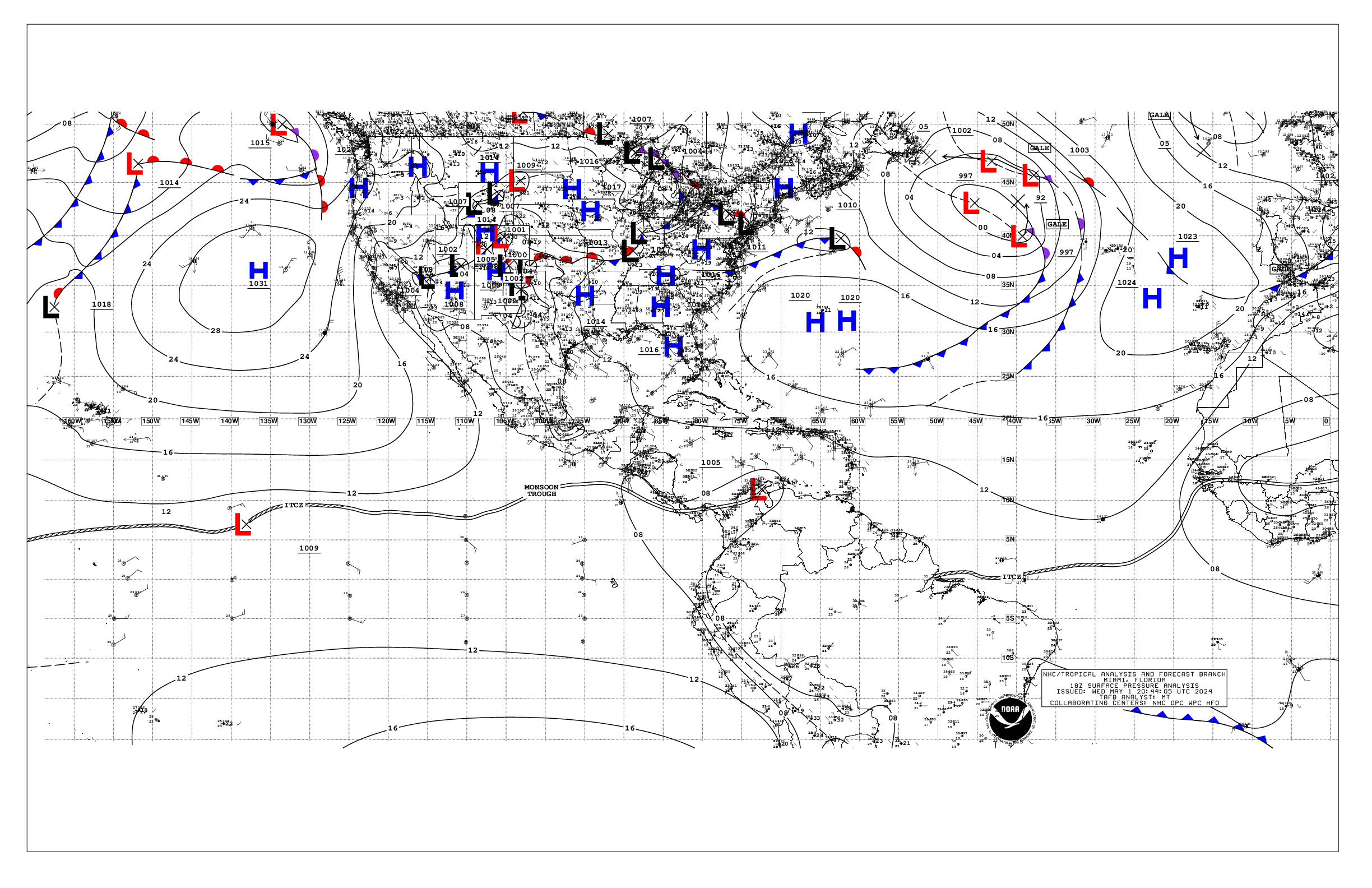
Based on 1800 UTC surface analysis and satellite imagery through
2200 UTC.

...SPECIAL FEATURES...

Tropical Depression Fay is centered near 28.9N 44.0W at 27/2100
UTC or 1010 nm WSW of the Azores, moving S at 4 kt. Estimated
minimum central pressure is 1011 mb. Maximum sustained wind
speed is 30 kt with gusts to 40 kt. Seas to 7 ft are within 60
nm of the depression. Numerous moderate convection is from 27N to
29N between 43W and 46W.

Please read the latest HIGH
SEAS FORECAST issued by the National Hurricane Center at website
- https://www.nhc.noaa.gov/text/MIAHSFAT2.shtml and the latest
Fay NHC Forecast/Advisory and Public Advisory at
www.hurricanes.gov for more details.

...TROPICAL WAVES...

A tropical wave is analyzed along 70W, south of 16N, moving west
at 10 kt. Scattered moderate convection has developed in advance
of this wave in the SW Caribbean.

...MONSOON TROUGH/ITCZ...

The monsoon trough extends from 16N25W to 08N42W. The ITCZ extends
from 08N42W to 11N60W. Scattered moderate convection is noted from
10N to 15N between 25W and 30W and from 10N to 14N between 55W and
60W.

...GULF OF AMERICA...

The surface reflection of a weakening stationary front has
dissipated over the southern basin, but scattered moderate
convection prevails S of 22N between 87W and 93W. A surface trough
extends across the SW basin. Light to gentle winds prevail, with
seas less than 2 ft.

For the forecast, light to gentle winds and slight to moderate
seas will prevail into tonight, then become gentle to moderate SE
winds across the basin through the early part of the week as high
pressure builds over the southeast U.S. Looking ahead, expect
moderate to fresh winds and building seas over mostly the western
Gulf starting mid week, as the high pressure shifts eastward ahead
of a cold front moving through the Southern Plains and
approaching the northwest Gulf by late Fri.

...CARIBBEAN SEA...

A weak pressure gradient, due to the passage of a cold front N
of the region, is translating to gentle to moderate trades over the
eastern and central basin as well as in the Gulf of Honduras, and
light to gentle winds elsewhere. Seas are 3 to 5 ft basin- wide,
except slight in the NW Caribbean.

For the forecast, a weak pressure gradient, due to the passage of
a cold front N of the region, will support gentle to moderate
trades across the Caribbean through Mon night. Expect gentle to
moderate E to SE winds thereafter through mid week as the high
pressure build north of the area. Looking ahead, the pattern will
allow moderate to fresh winds and building seas by Thu, with rough
seas possible in the Yucatan Channel and far northwest Caribbean
Thu night through Fri.

...ATLANTIC OCEAN...

Please see the Special Features section above for information on
Tropical Depression Fay.

A surface trough extends from 30N62W to the SE Bahamas and central
Cuba. Numerous thunderstorms associated with this boundary are N
of 24N between 62W and 72W. Moderate to fresh SW winds are noted E
of the trough, with rough seas behind it.  The remnants of
Gonzalo are near 21N23W 1010 mb. It still has moderate to fresh
cyclonic winds and rough seas. Elsewhere across the basin,
moderate winds and seas dominate.

For the forecast west of 55W, gentle to moderate winds and slight
seas will dominate the region starting tonight. Looking ahead,
high pressure will build north of the area supporting moderate to
fresh E winds and 3-5 ft seas south of 25N by mid week.

$$
Konarik