ZCZC MIATWOEP ALL
TTAA00 KNHC DDHHMM
Tropical Weather Outlook
NWS National Hurricane Center Miami FL
500 PM PDT Sun Jul 19 2020
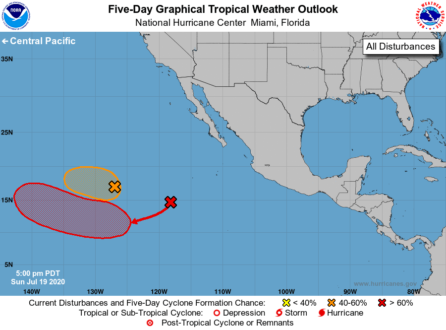
For the eastern North Pacific...east of 140 degrees west longitude:
1. A low pressure system is located a little more than 1200 miles
west-southwest of the southern tip of the Baja California peninsula.
Although the low is beginning to move over cooler waters, the
associated thunderstorm activity has increased over the past few
hours, and this system could become a short-lived tropical
depression later tonight or on Monday while it moves
west-northwestward at 10-15 mph.
* Formation chance through 48 hours...medium...50 percent.
* Formation chance through 5 days...medium...50 percent.
2. An area of showers and thunderstorms located about 800 miles
southwest of the southern tip of the Baja California peninsula is
showing some signs of organization. Environmental conditions are
expected to be conducive for development of this system, and a
tropical depression could form around the middle of the week while
it moves west-southwestward and then westward at about 10 mph.
* Formation chance through 48 hours...medium...40 percent.
* Formation chance through 5 days...high...70 percent.
Forecaster Pasch