ZCZC MIATWOEP ALL
TTAA00 KNHC DDHHMM
Tropical Weather Outlook
NWS National Hurricane Center Miami FL
500 AM PDT Mon Oct 14 2019
For the eastern North Pacific...east of 140 degrees west longitude:
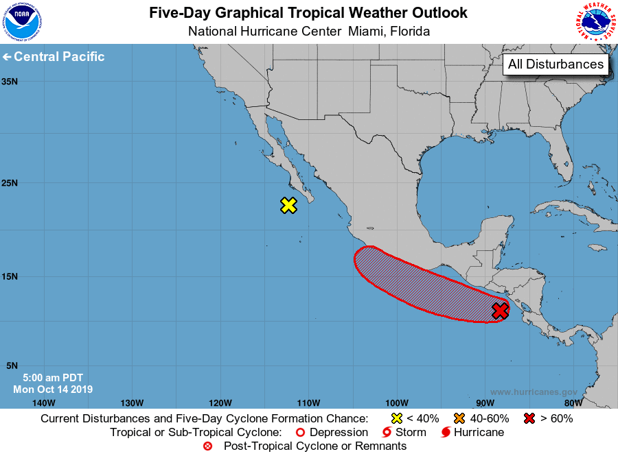
1. Disorganized showers and thunderstorms over portions of Baja
California Sur, the Gulf of California, and western Mexico are
associated with an elongated area of low pressure. Upper-level
winds have increased over the system, and the low has moved over
cooler waters. Therefore, development is no longer anticipated.
However, heavy rainfall associated with this system is likely to
continue across portions of Baja California Sur, southern Sonora,
and northern Sinaloa through today.
* Formation chance through 48 hours...low...near 0 percent.
* Formation chance through 5 days...low...near 0 percent.
2. A broad area of low pressure located a few hundred miles south of
the coast of Guatemala is producing disorganized showers and
thunderstorms. Gradual development is expected, and a tropical
depression is likely to form within the next few days while the
system moves west-northwestward at about 10 mph near or just
offshore the coast of Mexico. By late this week, the proximity to
land could inhibit further development.
* Formation chance through 48 hours...medium...50 percent.
* Formation chance through 5 days...high...80 percent.
Forecaster Latto