ZCZC MIATWOEP ALL
TTAA00 KNHC DDHHMM
Tropical Weather Outlook
NWS National Hurricane Center Miami FL
1100 PM PDT Wed Oct 17 2018
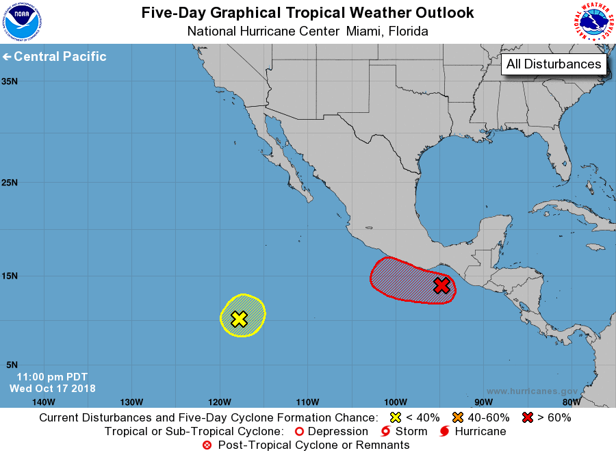
For the eastern North Pacific...east of 140 degrees west longitude:
1. An area of low pressure located south of the Gulf of Tehuantepec
has changed little in organization over the past several hours.
However, environmental conditions appear conducive for development,
and a tropical depression or tropical storm is likely to form during
the next day or two. The system is forecast to move generally toward
the west-northwest at 10 to 15 mph for the next several days, near
or just offshore the coast of southern Mexico.
* Formation chance through 48 hours...high...90 percent.
* Formation chance through 5 days...high...90 percent.
2. An elongated area of low pressure located about 900 miles
south-southwest of the southern tip of the Baja California peninsula
has become less defined since yesterday and is producing only
limited shower activity. Development of this system, if any, should
be slow to occur during the next few days while the system remains
nearly stationary or drifts slowly northeastward.
* Formation chance through 48 hours...low...near 0 percent.
* Formation chance through 5 days...low...10 percent.
Forecaster Zelinsky