ZCZC MIATWOEP ALL
TTAA00 KNHC DDHHMM
Tropical Weather Outlook
NWS National Hurricane Center Miami FL
1100 AM PDT Fri Aug 24 2018
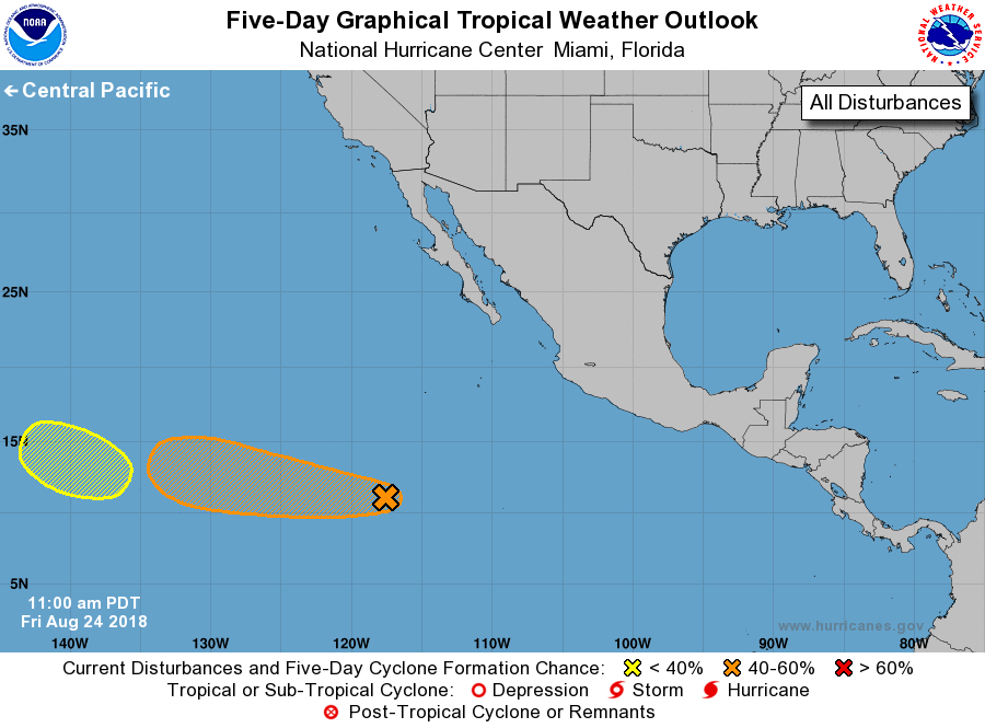
For the eastern North Pacific...east of 140 degrees west longitude:
1. A broad area of low pressure located about 1000 miles west-southwest
of the southern tip of the Baja California peninsula continues to
produce disorganized shower activity. Gradual development of this
system is possible during the next several days while the
disturbance moves westward around 10 mph.
* Formation chance through 48 hours...low...10 percent.
* Formation chance through 5 days...medium...50 percent.
2. An area of low pressure could form within the next few days well to
the east-southeast of the Hawaiian Islands. Development, if any, of
this system should be slow to occur next week while it moves
westward or west-northwestward at about 10 mph.
* Formation chance through 48 hours...low...near 0 percent.
* Formation chance through 5 days...low...20 percent.
Forecaster Cangialosi