ZCZC MIATWOEP ALL
TTAA00 KNHC DDHHMM
Tropical Weather Outlook
NWS National Hurricane Center Miami FL
500 AM PDT Sat Jun 23 2018
For the eastern North Pacific...east of 140 degrees west longitude:
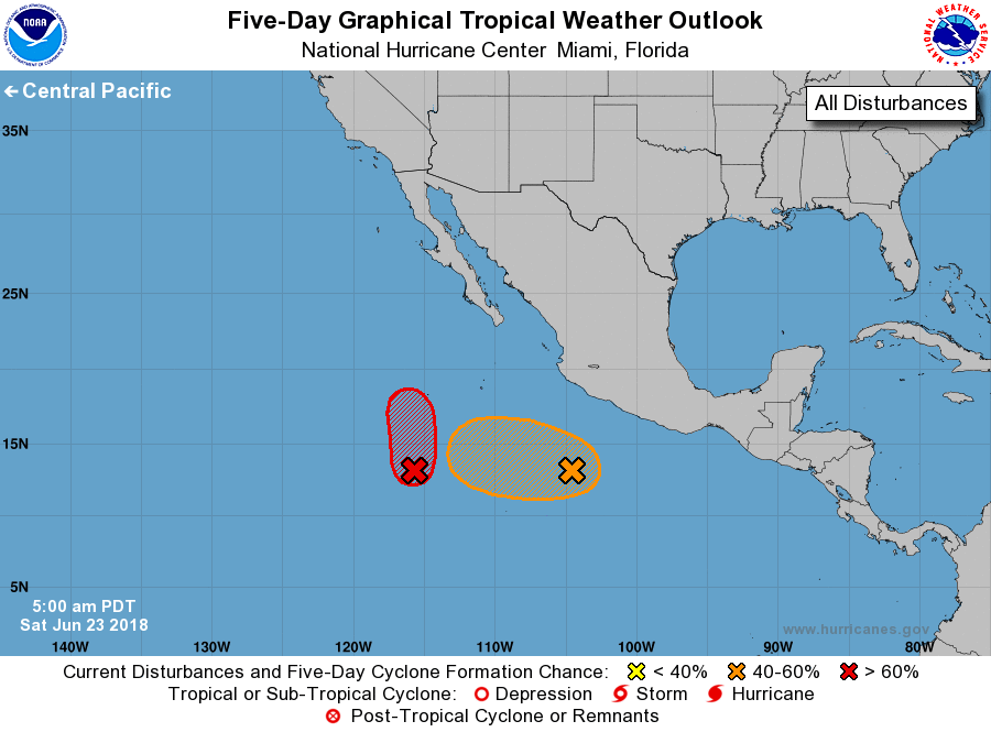
1. An elongated area of low pressure located several hundred miles
southwest of Acapulco, Mexico, continues to produce disorganized
shower and thunderstorm activity. Conditions may become more
conducive for development when a second weather system approaches
this disturbance from the east over the next several days, and a
tropical depression could form by the middle of next week well
offshore of the southwestern coast of Mexico.
* Formation chance through 48 hours...low...20 percent.
* Formation chance through 5 days...medium...60 percent.
2. Showers and thunderstorms are gradually becoming better organized
near an area of low pressure located about 800 miles south-southwest
of the southern tip of the Baja California peninsula, but satellite
wind data indicate that the low's circulation remains somewhat
elongated. Environmental conditions are expected to be conducive
for development while the system moves northward over the next day
or two, and a tropical depression is likely to form before the
system reaches colder waters on Monday.
* Formation chance through 48 hours...high...70 percent
* Formation chance through 5 days...high...70 percent
Forecaster Berg