ZCZC MIATWOEP ALL
TTAA00 KNHC DDHHMM
Tropical Weather Outlook
NWS National Hurricane Center Miami FL
500 PM PDT Tue Oct 3 2017
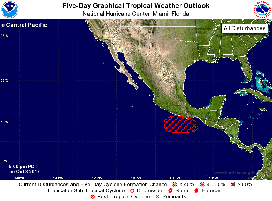
For the eastern North Pacific...east of 140 degrees west longitude:
1. An area of low pressure located just south of the Gulf of
Tehuantepec is continuing to produce disorganized showers and
thunderstorms. Satellite imagery indicates that the low-level
circulation associated with this system has become better defined
during the day today. Although the environment is not expected to
support significant development for the next few days, only a small
increase in the organization of shower and thunderstorm activity
would result in the formation of a tropical depression while the
system moves slowly toward the west or west-northwest.
* Formation chance through 48 hours...high...70 percent.
* Formation chance through 5 days...high...80 percent.
Forecaster Zelinsky