ZCZC MIATWOEP ALL
TTAA00 KNHC DDHHMM
TROPICAL WEATHER OUTLOOK
NWS NATIONAL HURRICANE CENTER MIAMI FL
1100 AM PDT FRI SEP 9 2016
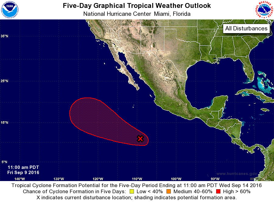
For the eastern North Pacific...east of 140 degrees west longitude:
1. Showers and thunderstorms associated with a broad area of low
pressure centered about 850 miles south of the southern tip of the
Baja California have only become slightly better organized since
yesterday. However, environmental conditions are conducive for
additional development, and a tropical depression is likely to form
late this weekend or early next week while the low moves west-
northwestward at 10 to 15 mph.
* Formation chance through 48 hours...medium...60 percent
* Formation chance through 5 days...high...80 percent
Forecaster Berg