ZCZC MIATWOEP ALL
TTAA00 KNHC DDHHMM
TROPICAL WEATHER OUTLOOK
NWS NATIONAL HURRICANE CENTER MIAMI FL
1100 AM PDT THU SEP 1 2016
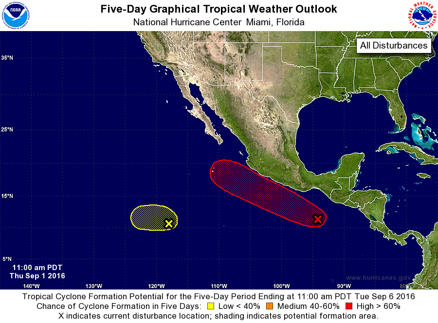
For the eastern North Pacific...east of 140 degrees west longitude:
1. Showers and thunderstorms continue to show signs of organization in
association with a trough of low pressure located several hundred
miles southeast of Acapulco, Mexico. Environmental conditions are
expected to be conducive for development, and a tropical depression
is likely to form over the weekend while the low moves west-
northwestward or northwestward near the coast of Mexico. Interests
along the southern and southwestern coast of Mexico should monitor
the progress of this disturbance. Locally heavy rain, flash floods
and mud slides are likely in these areas starting tomorrow and
continuing through the weekend.
* Formation chance through 48 hours...medium...60 percent
* Formation chance through 5 days...high...80 percent
2. A weak area of low pressure is located about 1000 miles south-
southwest of the southern tip of the Baja California peninsula.
This system is expected to drift westward during the next few days,
and any development should be slow to occur due to strong upper-
level winds.
* Formation chance through 48 hours...low...10 percent
* Formation chance through 5 days...low...20 percent
Forecaster Blake