ZCZC HFOTWOCP ALL
TTAA00 PHFO DDHHMM
Tropical Weather Outlook
NWS Central Pacific Hurricane Center Honolulu HI
200 PM HST Mon Aug 8 2022
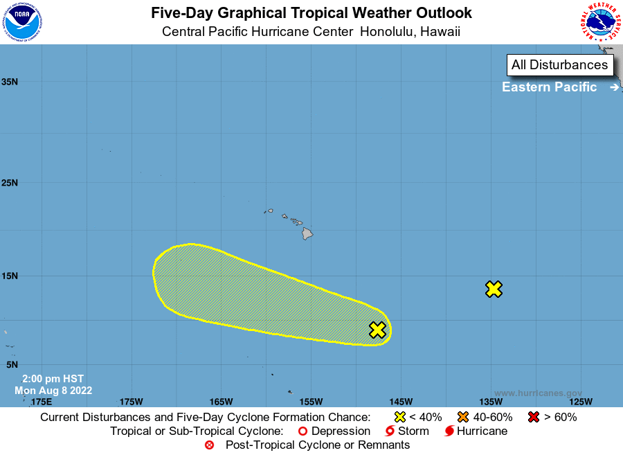
For the central North Pacific...between 140W and 180W:
1. Well South-Southeast of the Main Hawaiian Islands:
An area of low pressure could form around midweek within a broad
trough several hundred miles south-southeast of the main Hawaiian
Islands. Environmental conditions could allow for some gradual
development of this system as it moves quickly westward over the
central Pacific later this week.
* Formation chance through 48 hours...low...10 percent.
* Formation chance through 5 days.....low...30 percent.
2. Well East-Southeast of the Hawaiian Islands:
A large area of disorganized showers and thunderstorms is
associated with a broad trough of low pressure located more than
1000 miles east-southeast of the Hawaiian Islands. Environmental
conditions have become less conducive, and additional development is
no longer expected as the disturbance moves westward toward the
central Pacific basin.
* Formation chance through 48 hours...low...near 0 percent.
* Formation chance through 5 days...low...near 0 percent.
Elsewhere, no tropical cyclones are expected during the next 5 days.
Forecaster Burke