ZCZC MIATWOAT ALL
TTAA00 KNHC DDHHMM
Tropical Weather Outlook
NWS National Hurricane Center Miami FL
200 PM EDT Sat Jun 1 2019
For the North Atlantic...Caribbean Sea and the Gulf of Mexico:
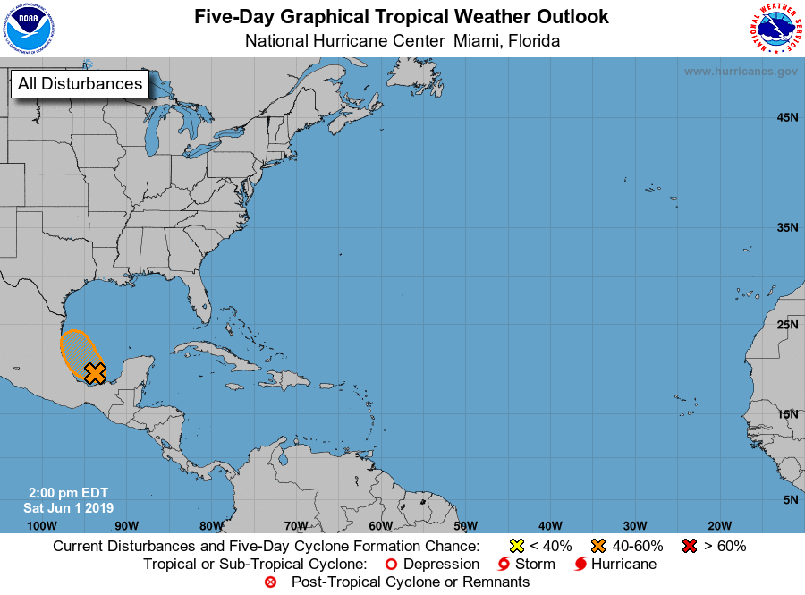
1. Recent satellite data indicate that circulation of a low pressure
system located over the southern Bay of Campeche has become a little
better defined today. However, the associated showers and
thunderstorms remain disorganized. This system is expected to move
slowly west-northwestward toward the coast of Mexico, and it could
become a tropical cyclone before it moves inland early next week.
Regardless of development, the disturbance will likely produce heavy
rainfall over portions of southern and eastern Mexico during the
next few days. An Air Force Reserve reconnaissance aircraft is
scheduled to investigate the disturbance on Sunday, if necessary.
Interests along the Gulf coast of Mexico should monitor the progress
of this system.
* Formation chance through 48 hours...medium...60 percent.
* Formation chance through 5 days...medium...60 percent.
Forecaster Cangialosi