ZCZC MIATWOAT ALL
TTAA00 KNHC DDHHMM
TROPICAL WEATHER OUTLOOK
NWS NATIONAL HURRICANE CENTER MIAMI FL
800 PM EDT THU OCT 20 2016
For the North Atlantic...Caribbean Sea and the Gulf of Mexico:
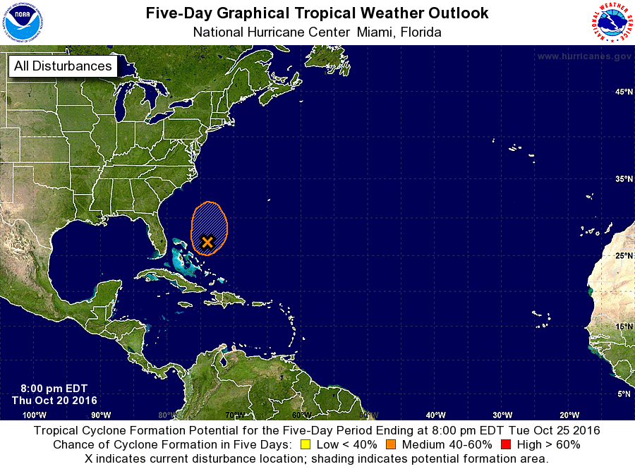
1. A broad area of low pressure centered a little more than 200 miles
east of the northwestern Bahamas is moving slowly northward. Data
from a NOAA Hurricane Hunter plane indicate that the low does not
have a well defined center, and the thunderstorm activity continues
to be limited. However, there is still an opportunity for this
system to become a subtropical or tropical cyclone before it merges
with an approaching cold front well offshore of the United States
east coast Friday night. Moisture from this system is causing
locally heavy rains along with life-threatening flash floods and
mud slides over portions of Hispaniola.
* Formation chance through 48 hours...medium...50 percent
* Formation chance through 5 days...medium...50 percent
Forecaster Avila