


NHC Graphical Outlook Archive
|
« Earliest Available ‹ Earlier Later › Latest Available » |
GIS Shapefiles |
| Eastern Pacific | Atlantic |
|
Tropical Weather Outlook Text
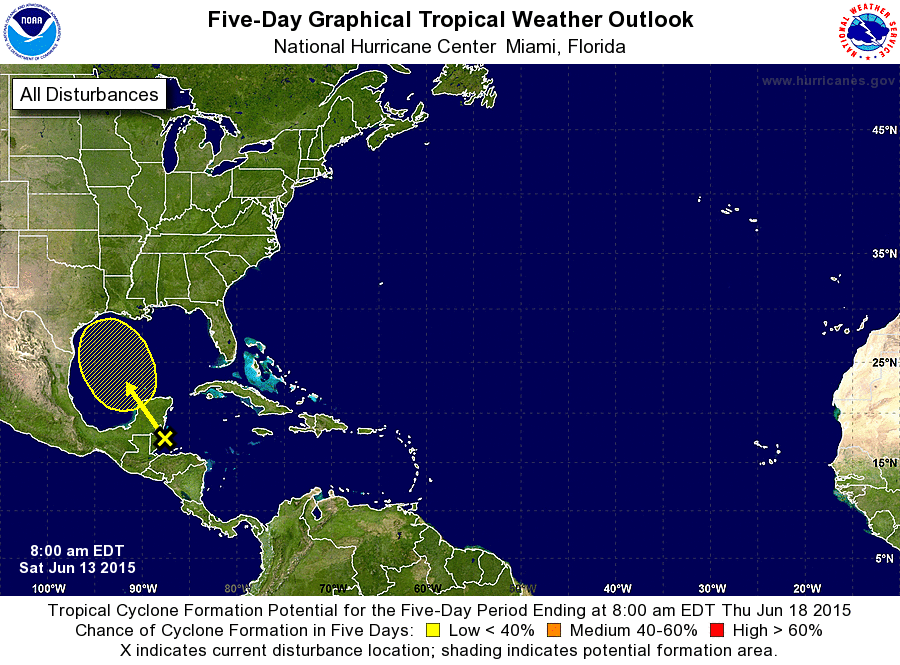
ZCZC MIATWOAT ALL
TTAA00 KNHC DDHHMM

TROPICAL WEATHER OUTLOOK
NWS NATIONAL HURRICANE CENTER MIAMI FL
800 AM EDT SAT JUN 13 2015

For the North Atlantic...Caribbean Sea and the Gulf of Mexico:

1. Showers and thunderstorms have increased across the northwestern
Caribbean Sea and adjacent land areas in association with a trough
of low pressure that has recently formed at the surface. This system
is expected to move across the Yucatan peninsula later today and
into the southwestern Gulf of Mexico by late tomorrow. Environmental
conditions could support slow development of this system during the
next few days while it moves generally northwestward.
* Formation chance through 48 hours...low...20 percent
* Formation chance through 5 days...low...30 percent

Forecaster Cangialosi/Blake
List of Atlantic Outlooks (May 2023 - present)
List of East Pacific Outlooks (May 2023 - present)
List of Central Pacific Outlooks (May 2023 - present)
List of Atlantic Outlooks (July 2014 - April 2023)
List of East Pacific Outlooks (July 2014 - April 2023)
List of Central Pacific Outlooks (June 2019 - April 2023)
List of Atlantic Outlooks (June 2009 - June 2014)
List of East Pacific Outlooks (June 2009 - June 2014)