ZCZC MIATWOAT ALL
TTAA00 KNHC DDHHMM
Tropical Weather Outlook
NWS National Hurricane Center Miami FL
800 AM EDT Sat Jun 16 2018
For the North Atlantic...Caribbean Sea and the Gulf of Mexico:
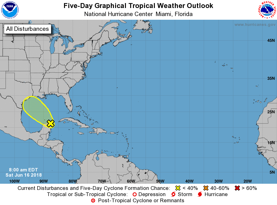
1. Disorganized showers and thunderstorms associated with a surface
trough and an upper-level low are occuring over the Yucatan
Peninsula and the southern Gulf of Mexico. Although environmental
conditions are not expected to be favorable for significant
development, heavy rains and gusty winds are likely to spread across
the central Gulf of Mexico today and will reach portions of the
Texas and southwestern Louisiana coasts on Sunday. For more details
on this system please see products issued by your local weather
office and High Seas Forecasts issued by the National Weather
Service.
* Formation chance through 48 hours...low...10 percent.
* Formation chance through 5 days...low...10 percent.
High Seas Forecasts issued by the National Weather Service can be
found under AWIPS header NFDHSFAT1, WMO header FZNT01 KWBC, and
on the Web at https://ocean.weather.gov/shtml/NFDHSFAT1.shtml.
Forecaster Zelinsky