ZCZC MIATWOAT ALL
TTAA00 KNHC DDHHMM
Tropical Weather Outlook
NWS National Hurricane Center Miami FL
800 PM EDT Mon Jul 3 2017
For the North Atlantic...Caribbean Sea and the Gulf of Mexico:
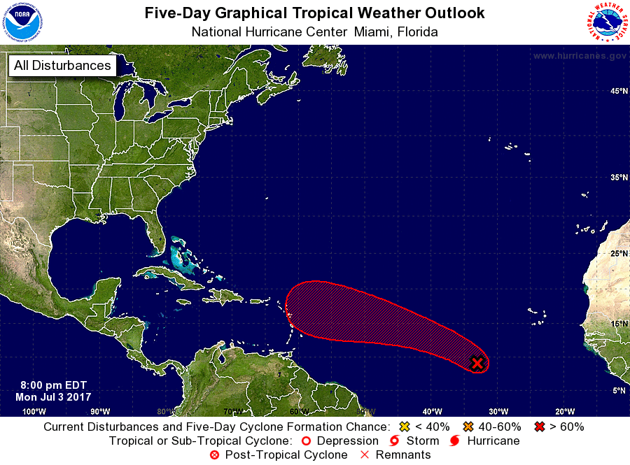
1. Showers and thunderstorms associated with a nearly stationary area
of low pressure located about 700 miles southwest of the Cabo Verde
Islands have become a little better organized since yesterday.
Additional development is likely, and a tropical depression could
form during the next several days before environmental conditions
become a little less conducive for development at the end of the
week. The disturbance is expected to begin moving slowly
northwestward on Tuesday, followed by a faster west-northwestward
motion across the tropical Atlantic Ocean through the remainder of
the week.
* Formation chance through 48 hours...medium...40 percent.
* Formation chance through 5 days...high...70 percent.
Forecaster Berg