ZCZC MIATWOAT ALL
TTAA00 KNHC DDHHMM
TROPICAL WEATHER OUTLOOK
NWS NATIONAL HURRICANE CENTER MIAMI FL
700 PM EST SUN NOV 20 2016
For the North Atlantic...Caribbean Sea and the Gulf of Mexico:
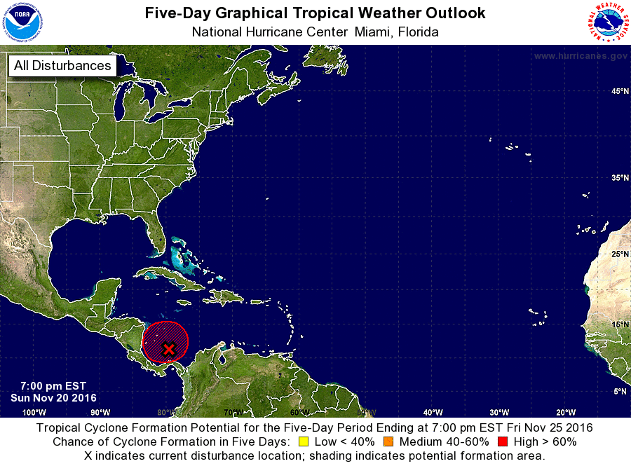
1. Shower and thunderstorm activity associated with a well-defined low
pressure area over the extreme southwestern Caribbean Sea have
become a little better organized during the past couple of hours.
Environmental conditions are conducive for additional development,
and a tropical depression is likely to form tonight or Monday while
the low remains nearly stationary. For additional information on
this system, see High Seas Forecasts issued by the National Weather
Service.
* Formation chance through 48 hours...high...80 percent
* Formation chance through 5 days...high...90 percent
High Seas Forecasts issued by the National Weather Service can be
found under AWIPS header NFDHSFAT1, WMO header FZNT01 KWBC, and
at http://www.opc.ncep.noaa.gov/shtml/NFDHSFAT1.shtml.
Forecaster Brown