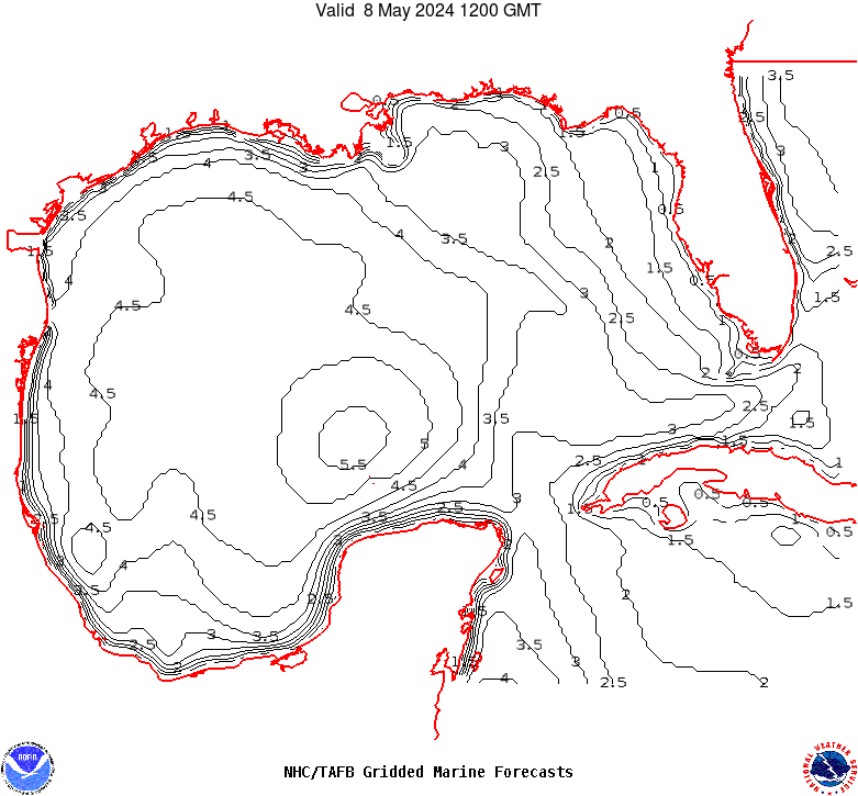
GMZ001-180730-
Synopsis for the Gulf of Mexico
319 PM EDT Wed Apr 17 2024

.SYNOPSIS...The pressure gradient between low pressure over Mexico
and surface ridging extending from the SW N Atlantic waters will
sustain moderate to fresh SE winds basin-wide through Sun morning,
except for strong winds ENE winds pulsing off the NW Yucatan
peninsula and south-central Gulf at night. A cold front is
forecast to move into the NW Gulf Sun afternoon, reach from Tampa
Bay to 25N90W to SW to 22N95W Mon morning and exit the basin Mon
evening. Moderate to fresh NE winds will follow the front, briefly
reaching strong speeds over the NE Mexico offshore waters Sun
evening.