ZCZC MIATWOEP ALL
TTAA00 KNHC DDHHMM
Tropical Weather Outlook
NWS National Hurricane Center Miami FL
500 AM PDT Wed Oct 12 2022
For the eastern North Pacific...east of 140 degrees west longitude:
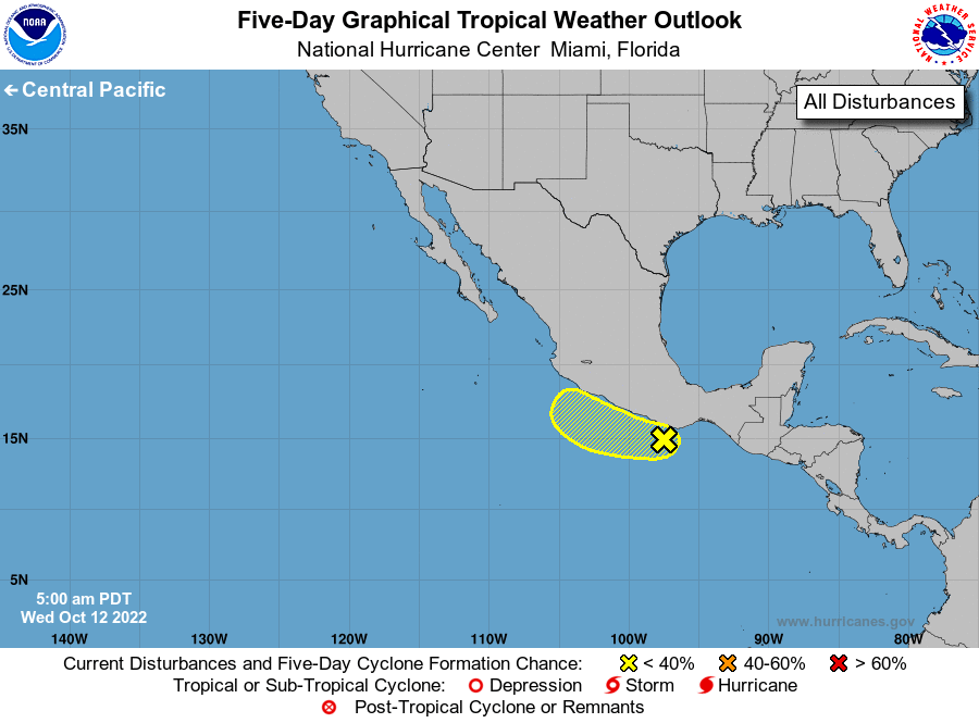
1. Near the coast of Southern Mexico:
A small area of low pressure located near the coast of southern
Mexico is partially related to the remnants of Julia. Although
showers and thunderstorms are currently disorganized, some slow
development is possible during the next couple of days, if the
system remains offshore. Regardless of development, heavy rainfall
could cause flash flooding across portions of southern and
southwestern Mexico during the next few days.
* Formation chance through 48 hours...low...20 percent.
* Formation chance through 5 days...low...30 percent.
Forecaster Bucci/Cangialosi