ZCZC MIATWOEP ALL
TTAA00 KNHC DDHHMM
Tropical Weather Outlook
NWS National Hurricane Center Miami FL
1100 PM PDT Tue Oct 11 2022
For the eastern North Pacific...east of 140 degrees west longitude:
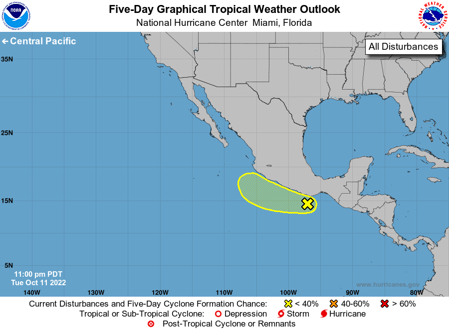
1. Near the coast of Southern Mexico:
A small area of low pressure has formed, partially related to
Julia's remains, a little less than a hundred miles to the south of
the coast of southern Mexico. Environmental conditions are
marginally favorable for some additional development of this system
through the end of this week, as long as it remains offshore.
Regardless of development, heavy rainfall could cause flash flooding
across portions of southern Mexico during the next several days.
* Formation chance through 48 hours...low...20 percent.
* Formation chance through 5 days...low...30 percent.
Forecaster Papin