ZCZC MIATWOEP ALL
TTAA00 KNHC DDHHMM
Tropical Weather Outlook
NWS National Hurricane Center Miami FL
1100 AM PDT Tue Oct 11 2022
For the eastern North Pacific...east of 140 degrees west longitude:
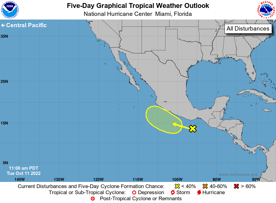
1. Near the coast of Southern Mexico:
Disorganized showers and thunderstorms extending from near the Gulf
of Tehuantepec southwestward for a few hundred miles are associated
with a surface trough and Julia's remnants. Development, if any,
of this system is likely to be slow to occur due to dry air aloft
and marginal upper-level winds. This system is forecast to move
westward to west-northwestward, near the coast of southern Mexico,
through the end of the week. Regardless of development, heavy
rainfall could cause flash flooding across portions of southern
Mexico during the next day or so.
* Formation chance through 48 hours...low...near 0 percent.
* Formation chance through 5 days...low...20 percent.
Forecaster Blake