ZCZC MIATWOEP ALL
TTAA00 KNHC DDHHMM
Tropical Weather Outlook
NWS National Hurricane Center Miami FL
500 AM PDT Tue Oct 11 2022
For the eastern North Pacific...east of 140 degrees west longitude:
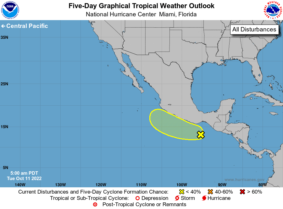
1. Near the coast of Southern Mexico:
Disorganized showers and thunderstorms extending from near the Gulf
of Tehuantepec southwestward for a couple of hundred miles are
associated with a surface trough and Julia's remnants. Some gradual
development of this system is possible if it remains offshore of
southern Mexico while it moves generally westward to
west-northwestward through the end of the week. Regardless of
development, heavy rainfall will likely cause flash flooding and
mudslides across portions of southern Mexico during the next day or
so.
* Formation chance through 48 hours...low...10 percent.
* Formation chance through 5 days...low...30 percent.
Forecaster Blake