ZCZC MIATWOEP ALL
TTAA00 KNHC DDHHMM
Tropical Weather Outlook
NWS National Hurricane Center Miami FL
1100 PM PDT Tue Oct 4 2022
For the eastern North Pacific...east of 140 degrees west longitude:
Active Systems:
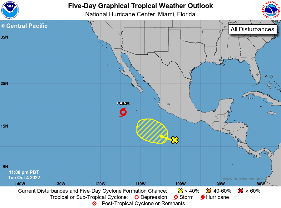
The National Hurricane Center is issuing advisories on Tropical
Storm Paine, located several hundred miles southwest of the southern
tip of the Baja California peninsula.
1. South of southern Mexico:
A broad area of low pressure located several hundred miles south of
Acapulco, Mexico, is currently producing only a few showers and
thunderstorms. Development of this system is unlikely due to strong
upper-level winds and nearby dry air. The low is forecast to move
generally westward to west-northwestward, remaining south of the
coasts of southern and southwestern Mexico.
* Formation chance through 48 hours...low...near 0 percent.
* Formation chance through 5 days...low...near 0 percent.
Forecaster Bucci