ZCZC MIATWOEP ALL
TTAA00 KNHC DDHHMM
Tropical Weather Outlook
NWS National Hurricane Center Miami FL
500 PM PDT Sat Oct 1 2022
For the eastern North Pacific...east of 140 degrees west longitude:
Active Systems:
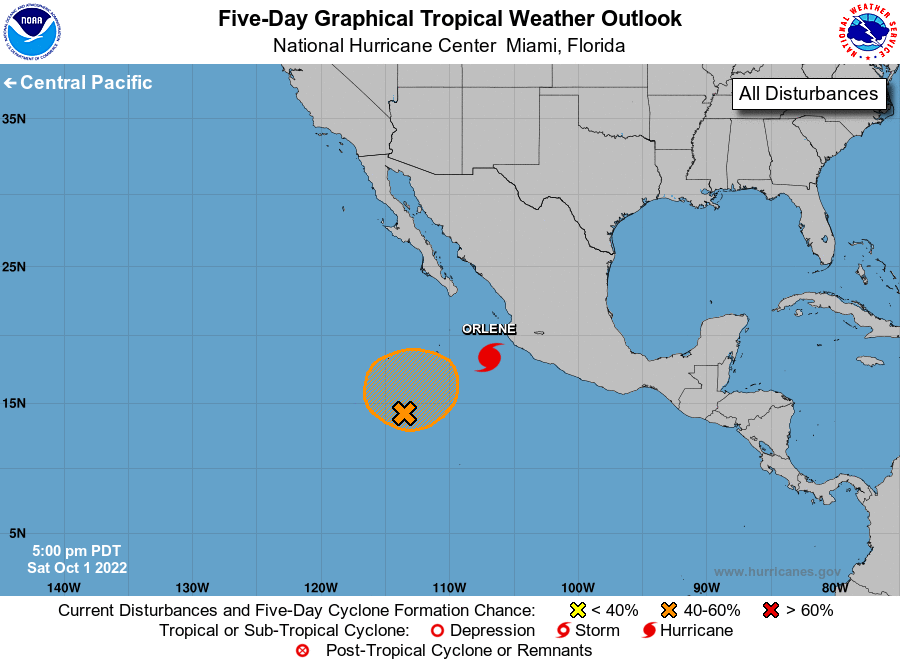
The National Hurricane Center is issuing advisories on Hurricane
Orlene, located a couple hundred miles south-southwest of Cabo
Corrientes, Mexico.
1. South-Southwest of the Baja California Peninsula:
Shower activity associated with a broad area of low pressure located
several hundred miles south-southwest of the southern tip of the
Baja California peninsula continues to show signs of organization.
Additional slow development of this system is possible, and a
tropical depression could form during the next couple of days or so
as it moves slowly northeastward or northward.
* Formation chance through 48 hours...medium...40 percent.
* Formation chance through 5 days...medium...50 percent.
Forecaster Bucci