ZCZC MIATWOEP ALL
TTAA00 KNHC DDHHMM
Tropical Weather Outlook
NWS National Hurricane Center Miami FL
1100 PM PDT Thu Sep 22 2022
For the eastern North Pacific...east of 140 degrees west longitude:
Active Systems:
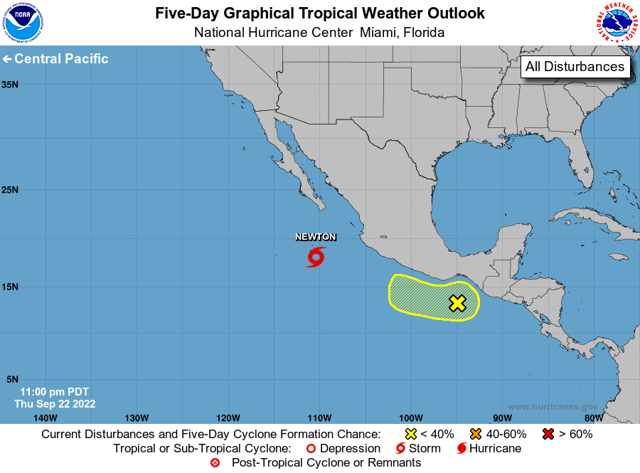
The National Hurricane Center is issuing advisories on Tropical
Storm Newton, located a few hundred miles south of the southern tip
of the Baja California peninsula.
1. South of Southern Mexico:
Disorganized showers and thunderstorms continue just south of the
Gulf of Tehuantepec associated with a trough of low pressure.
Development, if any, of this system should be slow to occur while it
moves west-northwestward off the coast of southern and southwestern
Mexico during the next few days.
* Formation chance through 48 hours...low...10 percent.
* Formation chance through 5 days...low...20 percent.
Forecaster Papin