ZCZC MIATWOEP ALL
TTAA00 KNHC DDHHMM
Tropical Weather Outlook
NWS National Hurricane Center Miami FL
Issued by the NWS Weather Prediction Center College Park MD
1100 AM PDT Wed Sep 21 2022
For the eastern North Pacific...east of 140 degrees west longitude:
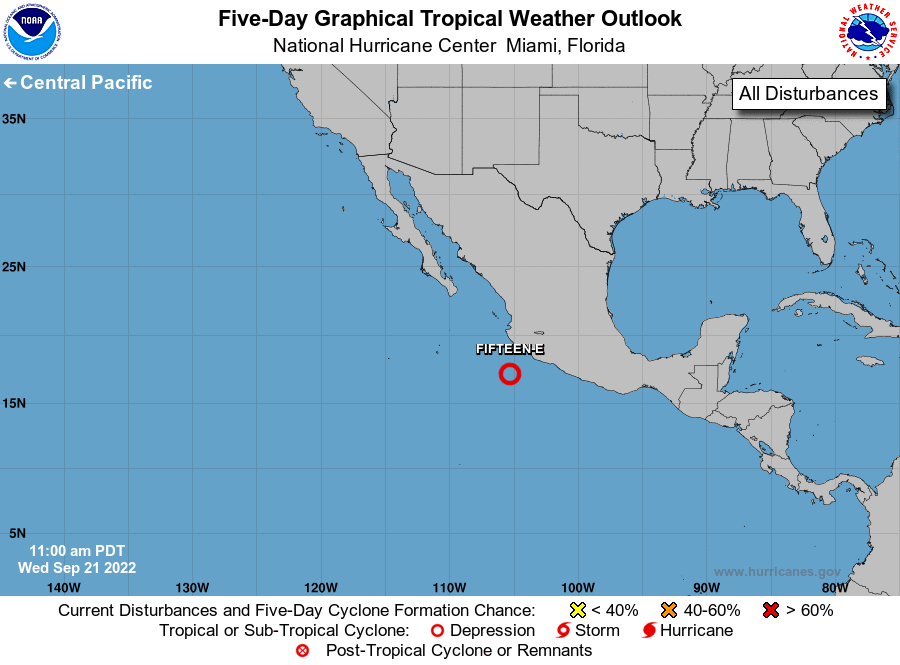
1. South of Southwestern Mexico:
Showers and thunderstorms associated with a broad area of low
pressure just offshore of southwestern Mexico have changed little
in organization today. A short-lived tropical depression is likely
to form during the next day or so before the system moves over
cooler waters and into a drier environment. This system is expected
to move west-northwestward just south of southwestern Mexico over
the next day or so, and then move away from the coast of Mexico.
* Formation chance through 48 hours...high...70 percent.
* Formation chance through 5 days...high...70 percent.
Forecaster Cangialosi/Wegman/Carbin