ZCZC MIATWOEP ALL
TTAA00 KNHC DDHHMM
Tropical Weather Outlook
NWS National Hurricane Center Miami FL
1100 PM PDT Sun Sep 11 2022
For the eastern North Pacific...east of 140 degrees west longitude:
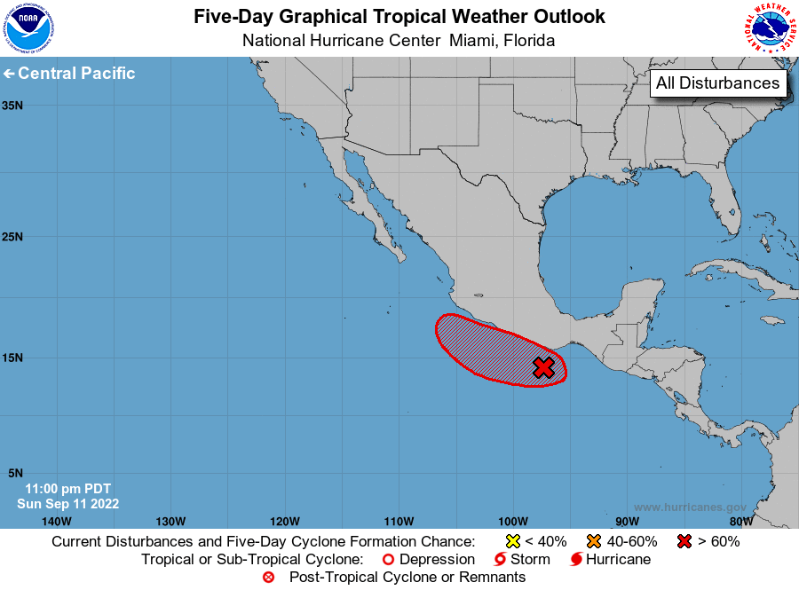
1. Near the coast of southern Mexico:
A trough of low pressure located along the coast of southern Mexico
is associated with a broad area of disorganized showers and
thunderstorms. This system is forecast to interact and merge with
another disturbance located farther west, and environmental
conditions are expected to be generally conducive for additional
development over the next several days. A tropical depression is
likely to form by the middle to latter part of this week while the
system moves slowly westward near the coast of southern and
southwestern Mexico.
* Formation chance through 48 hours...low...10 percent.
* Formation chance through 5 days...high...70 percent.
Forecaster Papin