ZCZC MIATWOEP ALL
TTAA00 KNHC DDHHMM
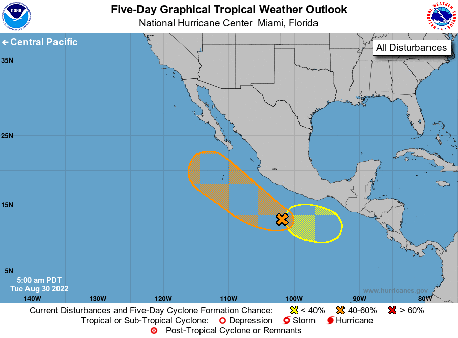
Tropical Weather Outlook
NWS National Hurricane Center Miami FL
500 AM PDT Tue Aug 30 2022
For the eastern North Pacific...east of 140 degrees west longitude:
1. Offshore of Southwestern Mexico:
A tropical wave located a few hundred miles south-southwest of
Acapulco, Mexico is producing an area of disorganized showers and
thunderstorms. Environmental conditions are forecast to be conducive
for gradual development during the next few days, and a tropical
depression could form later this week. The system is forecast to
move west-northwestward or northwestward, likely remaining a few
hundred miles off the coast of southwestern Mexico.
* Formation chance through 48 hours...low...30 percent.
* Formation chance through 5 days...medium...60 percent.
2. South of Southern Mexico:
An area of low pressure is forecast to form south of the southern
coast of Mexico by late this week. Some gradual development of this
system is possible over the weekend while it moves westward or
west-northwestward near the coast of southern Mexico.
* Formation chance through 48 hours...low...near 0 percent.
* Formation chance through 5 days...low...20 percent.
Forecaster Reinhart