ZCZC MIATWOEP ALL
TTAA00 KNHC DDHHMM
Tropical Weather Outlook
NWS National Hurricane Center Miami FL
1100 AM PDT Mon Aug 22 2022
For the eastern North Pacific...east of 140 degrees west longitude:
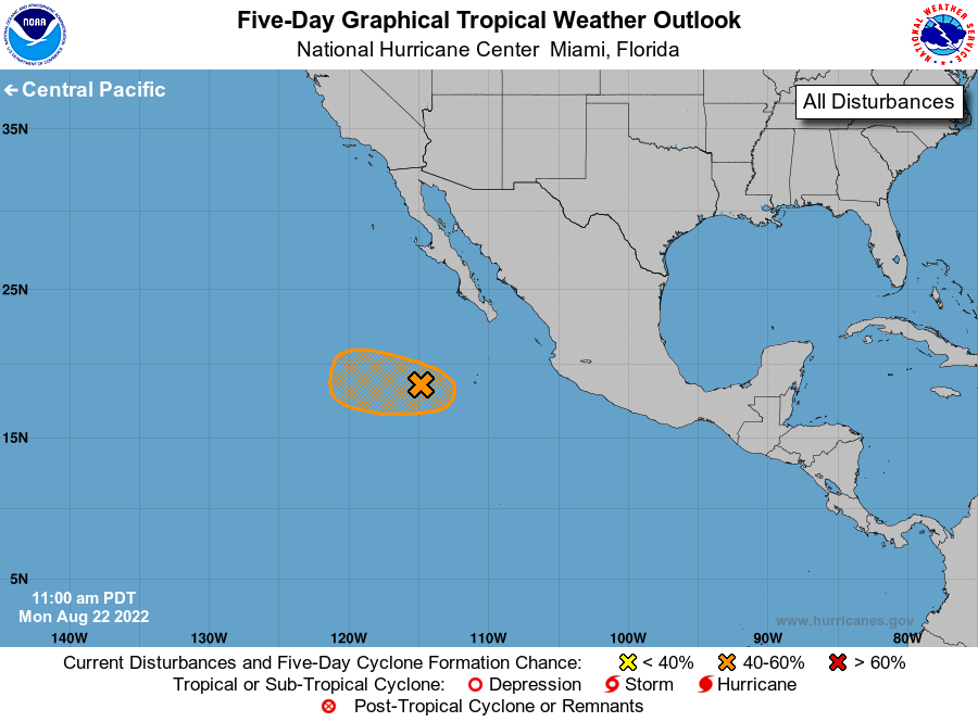
1. Central East Pacific:
A broad area of low pressure located several hundred miles southwest
of the southern tip of the Baja California peninsula is producing
disorganized showers and thunderstorms. Environmental conditions
appear generally favorable for additional development, and a
tropical depression could form over the next day or so as the system
moves westward or west-northwestward, well offshore of the coast of
Mexico. By midweek, less favorable environmental conditions could
limit further development.
* Formation chance through 48 hours...medium...40 percent.
* Formation chance through 5 days...medium...40 percent.
Forecaster Latto