ZCZC MIATWOEP ALL
TTAA00 KNHC DDHHMM
Tropical Weather Outlook
NWS National Hurricane Center Miami FL
1100 AM PDT Thu Aug 11 2022
For the eastern North Pacific...east of 140 degrees west longitude:
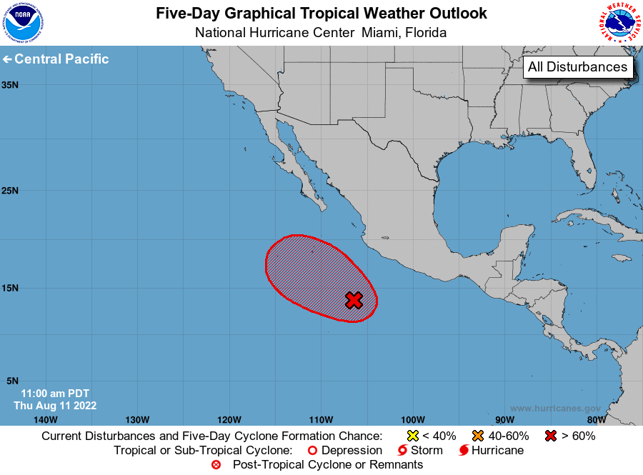
Offshore of Southwestern Mexico:
Showers and thunderstorms associated with an area of low pressure
located several hundred miles south of the coast of southwestern
Mexico have become better organized during the past several hours.
Environmental conditions appear conducive for additional development
and a tropical depression is likely to form during the next day or
two. This system is forecast to move west-northwestward or
northwestward at about 10 mph, well offshore the coast of Mexico
through the weekend. The disturbance should move into an environment
that is less conducive for development by Sunday, and further
development will be unlikely at that time.
1. * Formation chance through 48 hours...high...70 percent.
* Formation chance through 5 days...high...70 percent.
Forecaster D. Zelinsky