ZCZC MIATWOEP ALL
TTAA00 KNHC DDHHMM
Tropical Weather Outlook
NWS National Hurricane Center Miami FL
500 AM PDT Wed Jul 27 2022
For the eastern North Pacific...east of 140 degrees west longitude:
Active Systems:
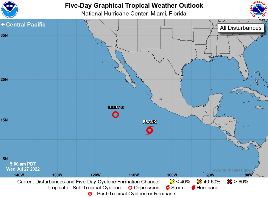
The National Hurricane Center is issuing advisories on Tropical
Storm Frank, located several hundred miles south of Manzanillo,
Mexico.
1. South of Baja California peninsula:
Shower and thunderstorm activity associated with a low pressure area
located several hundred miles southwest of the southern tip of
the Baja California peninsula has increased and is showing signs of
organization this morning. Only a small additional increase in
organization would lead to the formation of a tropical depression,
possibly as soon as later today. The system is forecast to move
slowly westward or west-southwestward over the next few days and
could still interact with Tropical Storm Frank to its east at the
end of this week.
* Formation chance through 48 hours...high...70 percent.
* Formation chance through 5 days...high...70 percent.
Forecaster Papin