ZCZC MIATWOEP ALL
TTAA00 KNHC DDHHMM
Tropical Weather Outlook
NWS National Hurricane Center Miami FL
1100 AM PDT Sun Jul 24 2022
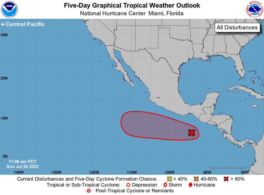
For the eastern North Pacific...east of 140 degrees west longitude:
1. Offshore of Southeastern Mexico:
Showers and thunderstorms are starting to show signs of organization
associated with a tropical wave located a couple of hundred miles
south off the coast of southeastern Mexico. Environmental conditions
appear conducive for further development, and this system is likely
to become a tropical depression by the middle part of this week.
This system is forecast to move generally westward at 10 to 15 mph,
remaining well south of the coast of southern and southwestern
Mexico during the next several days.
* Formation chance through 48 hours...medium...40 percent.
* Formation chance through 5 days...high...80 percent.
Forecaster Papin