ZCZC MIATWOEP ALL
TTAA00 KNHC DDHHMM
Tropical Weather Outlook
NWS National Hurricane Center Miami FL
1100 AM PDT Sat Jul 23 2022
For the eastern North Pacific...east of 140 degrees west longitude:
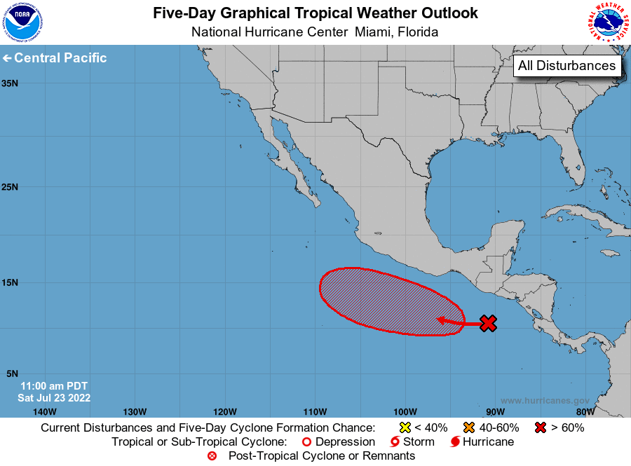
1. Offshore of Central America and Southern Mexico:
Disorganized showers and thunderstorms located a few hundred miles
south of the coast of Guatemala are associated with a tropical
wave. Environmental conditions are expected to be conducive for
gradual development of this system over the next several days, and
a tropical depression is likely to form by the middle of next week.
The disturbance is forecast to move generally westward at 10 to
15 mph remaining well south of the coast of southern Mexico.
* Formation chance through 48 hours...low...10 percent.
* Formation chance through 5 days...high...70 percent.
Forecaster Brown