ZCZC MIATWOEP ALL
TTAA00 KNHC DDHHMM
Tropical Weather Outlook
NWS National Hurricane Center Miami FL
1100 AM PDT Tue Jul 12 2022
For the eastern North Pacific...east of 140 degrees west longitude:
Active Systems:
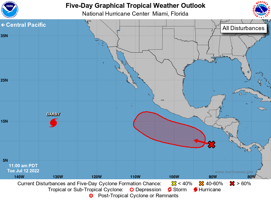
The National Hurricane Center is issuing advisories on Hurricane
Darby, located more than 1400 miles west-southwest of the southern
tip of the Baja California peninsula.
1. Offshore of Southern Mexico:
A broad area of low pressure has developed a few hundred miles south
of the coasts of Guatemala and El Salvador, and continues to produce
a broad area of disorganized showers and thunderstorms.
Environmental conditions appear conducive for gradual development
over the next several days, and this system is likely to become a
tropical depression towards the end of this week into the weekend.
The disturbance is forecast to drift westward for the next day or
so, then move west-northwestward at 10 to 15 mph later this week
while remaining offshore of the southern and southwestern coasts of
Mexico.
* Formation chance through 48 hours...low...10 percent.
* Formation chance through 5 days...high...80 percent.
Forecaster Papin