ZCZC MIATWOEP ALL
TTAA00 KNHC DDHHMM
Tropical Weather Outlook
NWS National Hurricane Center Miami FL
1100 PM PDT Wed Jul 6 2022
For the eastern North Pacific...east of 140 degrees west longitude:
Active Systems:
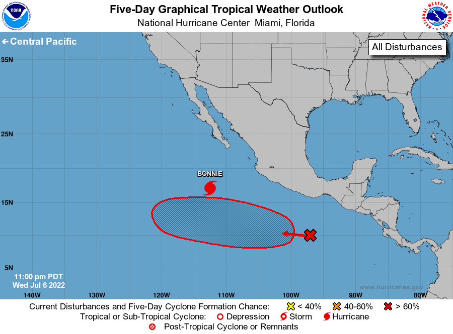
The National Hurricane Center is issuing advisories on Hurricane
Bonnie, located several hundred miles south-southwest of the
southern tip of the Baja California peninsula.
1. Offshore of Southern Mexico:
Showers and thunderstorms associated with a tropical wave located
several hundred miles south of the southern coast of Mexico have
become a little better organized since yesterday. Environmental
conditions are expected to be conducive for gradual development,
and a tropical depression is likely to form well south or southwest
of the southwestern coast of Mexico over the weekend while the
disturbance moves generally west-northwestward at 10 to 15 mph.
* Formation chance through 48 hours...low...30 percent.
* Formation chance through 5 days...high...70 percent.
Forecaster Beven