ZCZC MIATWOEP ALL
TTAA00 KNHC DDHHMM
Tropical Weather Outlook
NWS National Hurricane Center Miami FL
500 PM PDT Mon Jun 27 2022
For the eastern North Pacific...east of 140 degrees west longitude:
Active Systems:
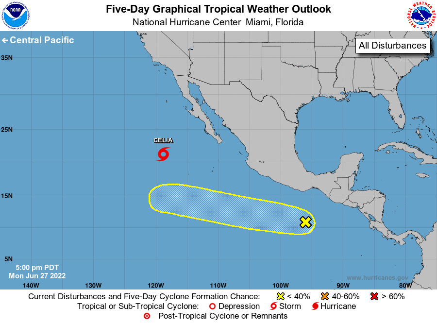
The National Hurricane Center is issuing advisories on Tropical
Storm Celia, located several hundred miles west-southwest of the
southern tip of the Baja California Peninsula.
1. Offshore of Southern Mexico:
A small but well-defined area of low pressure located a few hundred
miles offshore the coast of southern Mexico is producing some
disorganized shower and thunderstorm activity mainly to the north
and west of its center. Environmental conditions are forecast to
become more conducive for some gradual development during the next
few days while the system moves westward to west-northwestward at 10
to 15 mph.
* Formation chance through 48 hours...low...20 percent.
* Formation chance through 5 days...low...30 percent.
Forecaster Reinhart