ZCZC MIATWOEP ALL
TTAA00 KNHC DDHHMM
Tropical Weather Outlook
NWS National Hurricane Center Miami FL
1100 AM PDT Sun Jun 12 2022
For the eastern North Pacific...east of 140 degrees west longitude:
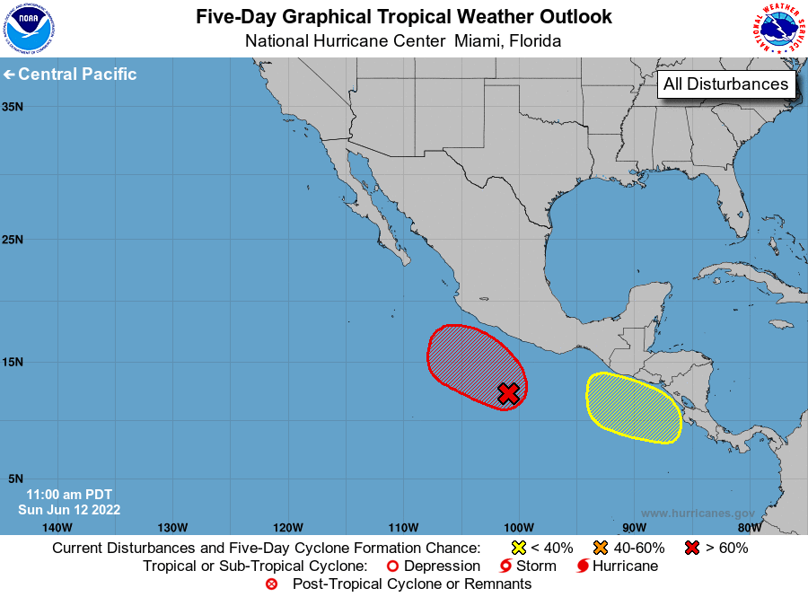
1. Off the coast of southwestern Mexico:
Showers and thunderstorms have increased since yesterday in
association with a broad low pressure area located a few hundred
miles south of the southwest coast of Mexico. Environmental
conditions are forecast to become more conducive for further
development, and a tropical depression is likely to form on Tuesday
or Wednesday while the system moves slowly northwestward off the
southwestern coast of Mexico.
* Formation chance through 48 hours...medium...50 percent.
* Formation chance through 5 days...high...90 percent.
2. Off the coast of Central America:
An area of low pressure is expected to form a couple of hundred
miles southwest of the coast of Nicaragua during the next day or
two. Gradual development of this system is possible through late
week while the low moves slowly northwestward.
* Formation chance through 48 hours...low...near 0 percent.
* Formation chance through 5 days...low...20 percent.
Forecaster Blake