ZCZC MIATWOEP ALL
TTAA00 KNHC DDHHMM
Tropical Weather Outlook
NWS National Hurricane Center Miami FL
1100 PM PDT Sun May 22 2022
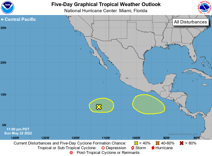
For the eastern North Pacific...east of 140 degrees west longitude:
1. Central-East Pacific well offshore of Southwestern Mexico:
A trough of low pressure located more than 500 miles southwest of
the coast of Mexico is producing a broad area of disorganized
showers and thunderstorms. Environmental conditions appear
marginally conducive for some slow development as this system drifts
slowly over the central part of the Eastern Pacific through the
latter portion of this week.
* Formation chance through 48 hours...low...10 percent.
* Formation chance through 5 days...low...20 percent.
2. South of the Gulf of Tehuantepec:
Another broad area of low pressure is forecast to form in a few days
several hundred miles south of the Gulf of Tehuantepec. Thereafter,
some slow development is possible while this system moves slowly
westward at 5 to 10 mph.
* Formation chance through 48 hours...low...near 0 percent.
* Formation chance through 5 days...low...20 percent.
Forecaster Papin