ZCZC MIATWOEP ALL
TTAA00 KNHC DDHHMM
Tropical Weather Outlook
NWS National Hurricane Center Miami FL
400 AM PST Sun Nov 7 2021
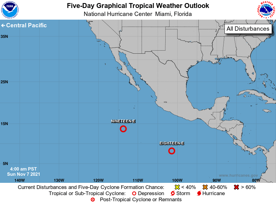
For the eastern North Pacific...east of 140 degrees west longitude:
The National Hurricane Center is issuing advisories on Tropical
Depression Eighteen-E, located about 600 miles south of Acapulco,
Mexico.
1. Showers and thunderstorms continue to show signs of organization in
association with a broad low pressure system located several hundred
miles south-southwest of the southern tip of the Baja California
peninsula. Recent polar-orbiting satellite data also suggests the
circulation is becoming better defined. If these trends continue,
this system is likely to become a short-lived tropical depression
later today while it moves west-northwestward at 5 to 10 mph.
Environmental conditions are expected to become less favorable for
further development by Monday.
* Formation chance through 48 hours...high...80 percent.
* Formation chance through 5 days...high...80 percent.
Forecaster Papin