ZCZC MIATWOEP ALL
TTAA00 KNHC DDHHMM
Tropical Weather Outlook
NWS National Hurricane Center Miami FL
500 PM PDT Sat Nov 6 2021
For the eastern North Pacific...east of 140 degrees west longitude:
The National Hurricane Center is issuing advisories on Tropical
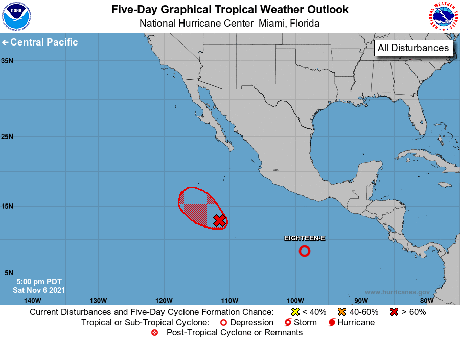
Depression Eighteen-E, located more than 500 miles south-southwest
of Salina Cruz, Mexico.
1. Although showers and thunderstorms continue to show signs of
organization in association with an area of low pressure located
several hundred miles south of the southern tip of the Baja
California peninsula, recent satellite data indicate that the
circulation is broad and elongated. This system is still likely to
become a short-lived tropical depression on Sunday as it moves
west-northwestward at 5 to 10 mph. Environmental conditions are
forecast to become less favorable for further development by early
next week.
* Formation chance through 48 hours...high...70 percent.
* Formation chance through 5 days...high...70 percent.
Forecaster Cangialosi