ZCZC MIATWOEP ALL
TTAA00 KNHC DDHHMM
Tropical Weather Outlook
NWS National Hurricane Center Miami FL
1100 AM PDT Sat Nov 6 2021
For the eastern North Pacific...east of 140 degrees west longitude:
The National Hurricane Center is issuing advisories on Tropical
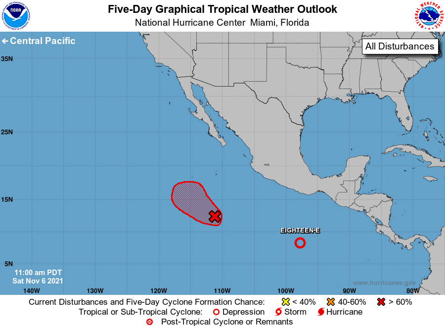
Depression Eighteen-E, located more than 500 miles south of Salina
Cruz, Mexico.
1. Showers and thunderstorms continue to show signs of organization in
association with an area of low pressure located several hundred
miles south of the southern tip of the Baja California peninsula.
Only a small increase in organization will likely lead to the
formation of a short-lived tropical depression either today or
tomorrow as the system moves west-northwestward at 5 to 10 mph.
Environmental conditions are forecast to become less favorable for
further development by early next week.
* Formation chance through 48 hours...high...80 percent.
* Formation chance through 5 days...high...80 percent.
Forecaster Papin