ZCZC MIATWOEP ALL
TTAA00 KNHC DDHHMM
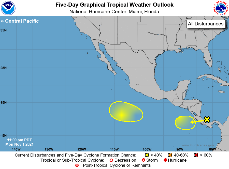
Tropical Weather Outlook
NWS National Hurricane Center Miami FL
1100 PM PDT Mon Nov 1 2021
For the eastern North Pacific...east of 140 degrees west longitude:
1. An area of low pressure located over the southwestern Caribbean Sea
is forecast to move across Central America on Tuesday, and over
the far eastern Pacific waters on Wednesday. Some slow development
of the system is possible thereafter while it moves westward at
around 10 mph.
* Formation chance through 48 hours...low...near 0 percent.
* Formation chance through 5 days...low...20 percent.
2. An area of low pressure is expected to form later this week several
hundred miles south of the southwestern coast of Mexico. Some slow
development of this system is possible thereafter while it moves
westward to west-northwestward at 5 to 10 mph.
* Formation chance through 48 hours...low...near 0 percent.
* Formation chance through 5 days...low...20 percent.
Forecaster Pasch