ZCZC MIATWOEP ALL
TTAA00 KNHC DDHHMM
Tropical Weather Outlook
NWS National Hurricane Center Miami FL
500 PM PDT Fri Oct 1 2021
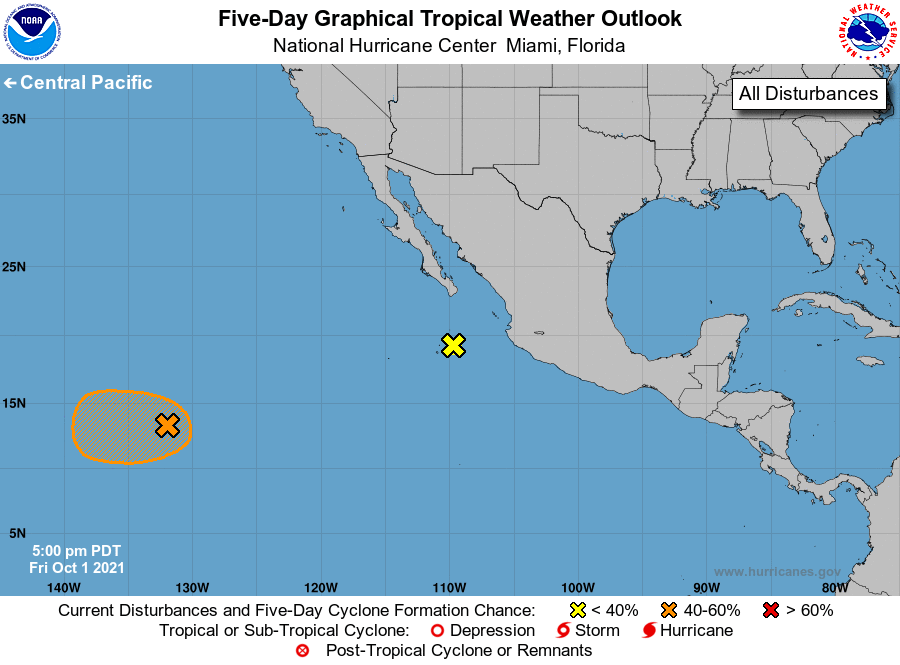
For the eastern North Pacific...east of 140 degrees west longitude:
1. Disorganized showers and thunderstorms have changed little in
organization in association with a broad area of low pressure
located about 1600 miles west-southwest of the southern tip of the
Baja California peninsula. Environmental conditions are somewhat
conducive for slow development during the next several days, and a
tropical depression could form over the weekend or early next week
while the system drifts westward.
* Formation chance through 48 hours...low...20 percent.
* Formation chance through 5 days...medium...40 percent.
2. A trough of low pressure is producing a few disorganized showers and
thunderstorms a few hundred miles west of Manzanillo, Mexico.
Development of this system is no longer anticipated due to
unfavorable environmental conditions as it moves generally
west-northwestward at 5 to 10 mph.
* Formation chance through 48 hours...low...near 0 percent.
* Formation chance through 5 days...low...near 0 percent.
Forecaster Papin