ZCZC MIATWOEP ALL
TTAA00 KNHC DDHHMM
Tropical Weather Outlook
NWS National Hurricane Center Miami FL
500 AM PDT Fri Oct 1 2021
For the eastern North Pacific...east of 140 degrees west longitude:
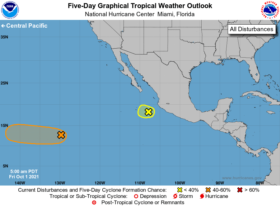
1. A broad area of low pressure located about 1500 miles west-southwest
of the southern tip of the Baja California peninsula is producing
disorganized showers and thunderstorms. Environmental conditions
are expected to be conducive for slow development during the next
several days, and a tropical depression could form over the weekend
or early next week while the system moves generally westward at
5 to 10 mph.
* Formation chance through 48 hours...low...20 percent.
* Formation chance through 5 days...medium...40 percent.
2. Disorganized showers and thunderstorms continue in association with
an elongated area of low pressure located a couple of hundred miles
west-southwest of Manzanillo, Mexico. This system is moving
west-northwestward at 5 to 10 mph, and some slow development is
possible through early today before it reaches an area of stronger
upper-level winds.
* Formation chance through 48 hours...low...20 percent.
* Formation chance through 5 days...low...20 percent.
Forecaster Latto