Skip Navigation Links
NOAA NOAA United States Department of Commerce

NHC Graphical Outlook Archive


« Earliest Available         ‹ Earlier         Later ›         Latest Available »
GIS Shapefiles
Central Pacific Eastern Pacific Atlantic

View 2-Day Graphical Tropical Weather Outlook
Click for Atlantic Click for Atlantic

Tropical Weather Outlook Text

ZCZC MIATWOEP ALL
TTAA00 KNHC DDHHMM

Tropical Weather Outlook
NWS National Hurricane Center Miami FL
500 PM PDT Wed Sep 22 2021

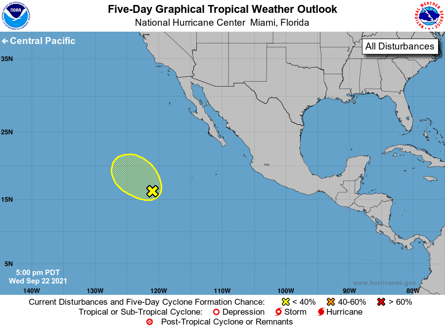
For the eastern North Pacific...east of 140 degrees west longitude:

1. A broad and elongated area of low pressure located several hundred 
miles southwest of the southern tip of the Baja California peninsula 
continues to produce disorganized showers and thunderstorms. 
Development of this system during the next day or so, if any, 
is likely to be slow.  After that time, this system is forecast to 
move into an environment of stable air and strong upper-level 
winds, which should inhibit further development.
* Formation chance through 48 hours...low...20 percent. 
* Formation chance through 5 days...low...20 percent.

Forecaster Brown


List of Atlantic Outlooks (May 2023 - present)
List of East Pacific Outlooks (May 2023 - present)
List of Central Pacific Outlooks (May 2023 - present)
List of Atlantic Outlooks (July 2014 - April 2023)
List of East Pacific Outlooks (July 2014 - April 2023)
List of Central Pacific Outlooks (June 2019 - April 2023)
List of Atlantic Outlooks (June 2009 - June 2014)
List of East Pacific Outlooks (June 2009 - June 2014)