ZCZC MIATWOEP ALL
TTAA00 KNHC DDHHMM
Tropical Weather Outlook
NWS National Hurricane Center Miami FL
500 AM PDT Wed Sep 22 2021
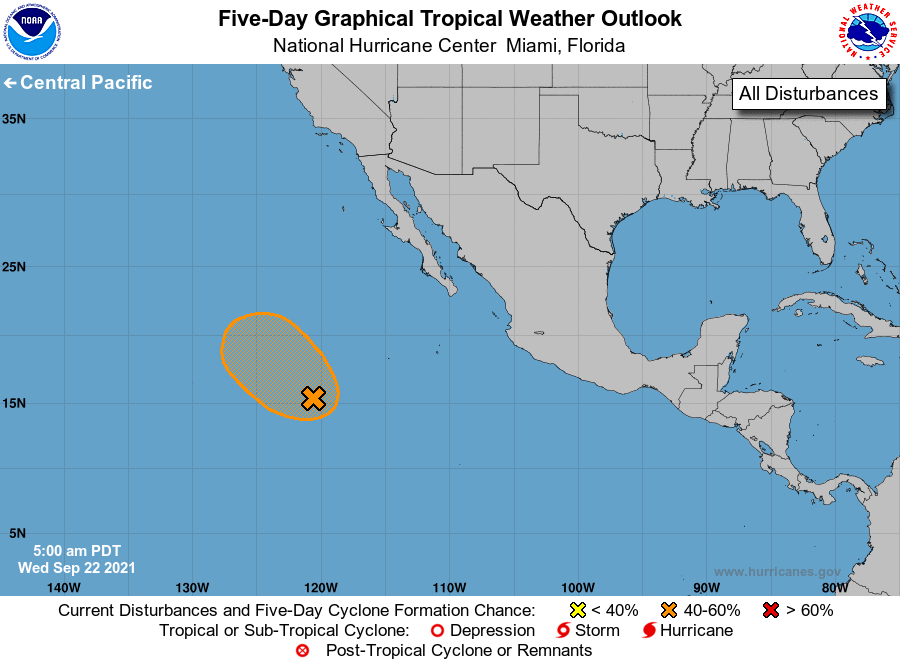
For the eastern North Pacific...east of 140 degrees west longitude:
1. A broad and elongated area of low pressure located several hundred
miles southwest of the southern tip of the Baja California peninsula
continues to produce disorganized showers and thunderstorms.
Environmental conditions are somewhat conducive for development, and
a short-lived tropical depression could form on Thursday or Friday
while the low moves generally northwestward at 10 to 15 mph. This
system is forecast to move over cooler waters and into an
environment of stable air and strong upper-level winds this weekend,
which should inhibit further development.
* Formation chance through 48 hours...medium...40 percent.
* Formation chance through 5 days...medium...50 percent.
Forecaster Beven