ZCZC MIATWOEP ALL
TTAA00 KNHC DDHHMM
Tropical Weather Outlook
NWS National Hurricane Center Miami FL
1100 PM PDT Sat Sep 11 2021
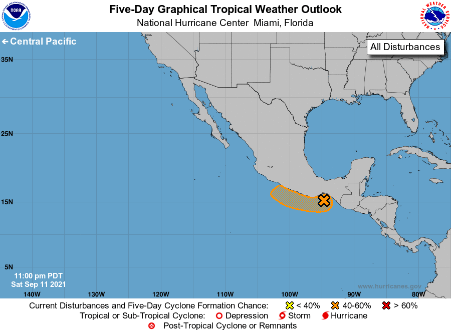
For the eastern North Pacific...east of 140 degrees west longitude:
1. An area of low pressure over the Gulf of Tehuantepec continues
to produce a large area of disorganized showers and thunderstorms.
Further development of this system is possible during the next
couple of days as long as it remains over water, and a tropical
depression could form tomorrow or early Monday while the system
moves northwestward toward the southern and southwestern coasts of
Mexico. Further development is not expected by midweek due to
interaction with land. Regardless of development, this system will
likely produce heavy rains across portions of southern Mexico during
the next couple of days.
* Formation chance through 48 hours...medium...60 percent.
* Formation chance through 5 days...medium...60 percent.
Forecaster Blake