ZCZC MIATWOEP ALL
TTAA00 KNHC DDHHMM
Tropical Weather Outlook
NWS National Hurricane Center Miami FL
1100 PM PDT Fri Sep 10 2021
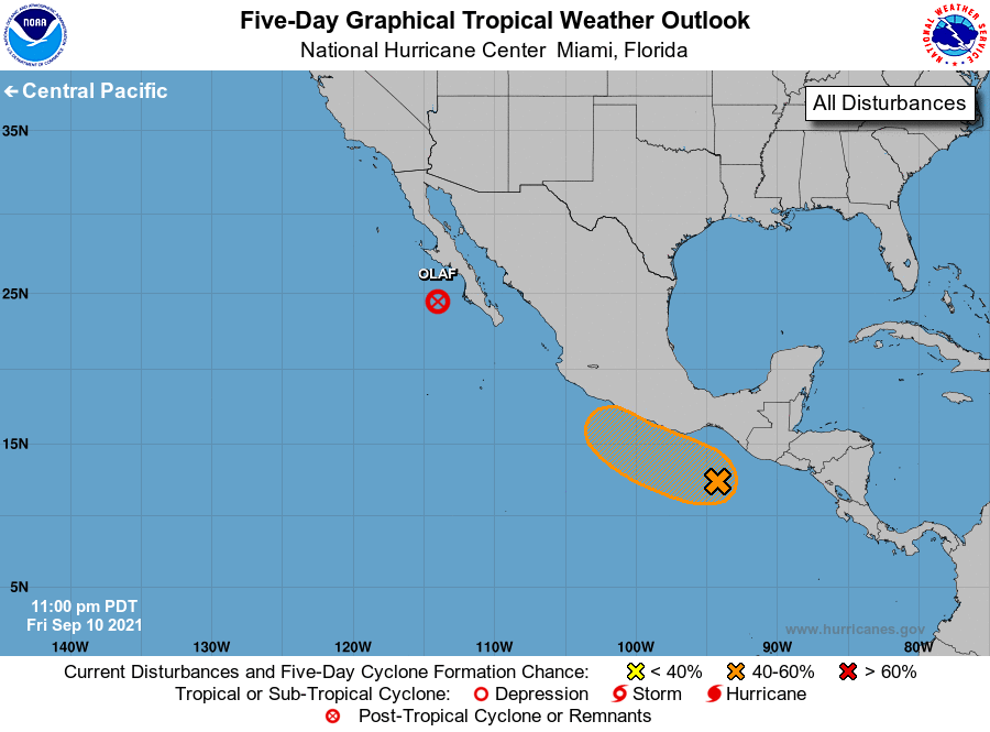
For the eastern North Pacific...east of 140 degrees west longitude:
The National Hurricane Center is issuing advisories on recently
downgraded Tropical Depression Olaf, located less than 100 miles
west of Cabo San Lazaro, Mexico.
1. A broad area of low pressure developing a couple of hundred miles
south of the Gulf of Tehuantepec is producing a large area of
disorganized showers and thunderstorms. Environmental conditions
are generally conducive for some development of this system if it
remains over water, and a tropical depression could form late this
weekend or early next week while moving west-northwestward at 5 to
10 mph near the southern and southwestern coasts of Mexico.
Regardless of development, this system will likely produce heavy
rains across portions of Central America and southern Mexico during
the next few days.
* Formation chance through 48 hours...medium...50 percent.
* Formation chance through 5 days...medium...60 percent.
Forecaster Berg